White Memorial: Japanese Tea House

img_7720

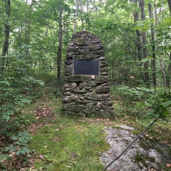
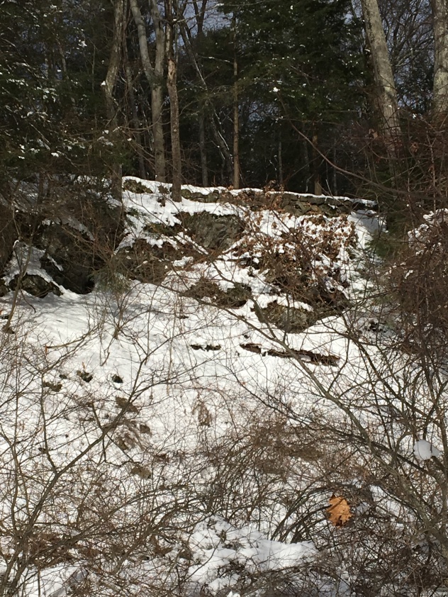
Remains of the Whites’ Japanese tea house

Many of the trails that wind through the White Memorial Conservation Center were originally constructed as carriage roads for Alain and May White. Great care was taken in building this network of roads, as evidenced by the many extant bridges, culverts, and drainage ditches. Carriage rides on roads carved out of forests was a popular leisure activity for wealthy Americans in the late 19th and early 20th century. The Rockefellers, for example, built 45 miles of carriage roads at Kykuit, their Tarrytown, New York, estate, eighteen miles or roads at their Forest Hill, Ohio, estate, and 57 miles in what is now Acadia National Park in Maine.
img_7718

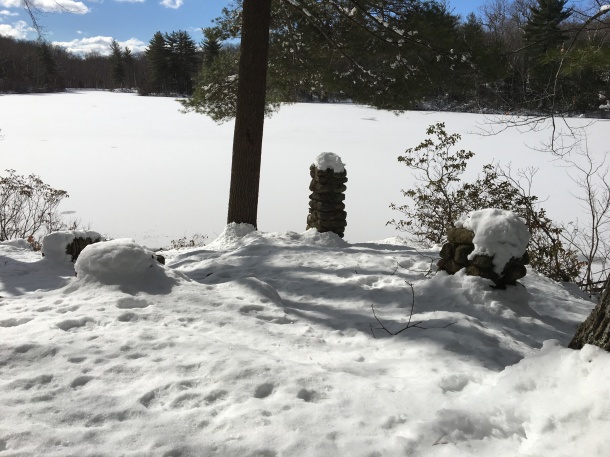
Beaver Pond overlook, White Memorial Foundation

Alain White oversaw the construction of dozens of miles of roads at Whitehall, what is now White Memorial. From the 1870 carriage house, the Whites would drive their team of horses around their property. Approximately four miles from their home was Beaver Pond. High above the pond they constructed a pull off so that they could admire the vista from their carriage. And on the shore of the pond, White built a Japanese tea house. Here Alain and May could entertain friends before returning back home.

Image result for frederick church

Frederic Church, Twilight in the Wilderness, 1860

Wealthy Americans of this period were captivated by paintings by the likes of Frederic Church and Winslow Homer of the American wilderness and looked to have their own experiences in nature. And if that could be done by constructing a Japanese tea house on ground seemingly untouched by human hands, so much the better. At about the same time, Robert Pruyn, an Albany banker and businessman, constructed an entire estate with a Japanese theme on nearly 100,000 of Adirondack wilderness in Newcomb, New York. If on a smaller scale, Alain and May White were inspired by similar ideas in Litchfield and Morris.

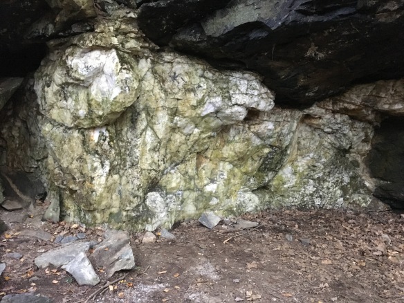
Hidden Nearby: An Autumn Walk to Steep Rock’s Quartz Mine

As with many of our other protected lands (Lover’s Leap State Park, Burr Pond State Park, the White Memorial Foundation), the Hidden Valley Preserve of Washington’s Steep Rock Association was once the site of industrial operations. The Hidden Valley, quiet today except for the sound of the rushing Shepaug River, once echoed with the sounds of quartz mining and locomotives. The glories of a New England Fall presents the perfect time to visit this piece of Litchfield County’s industrial heritage.

IMG_6713

A short walk along the northwestern bank of the river brings the hiker to the spectacular Thoreau Bridge, erected in 2015.

IMG_6683

Quotes from Thoreau are emblazoned on the bridge.

IMG_6704

On the eastern bank of the Shepaug River is this monument and bridged dedicated in honor of Washington native and West Point graduate Stephen Reich, killed in Afghanistan in 2005. 

IMG_6700

The trail passes old footpaths, cart paths, and the bed of the railroad used to haul the quartz out of the area, often to the Hudson River.

IMG_6707

Stone retaining walls in the woods mark the old road beds used to get wagons and carts to the mine.

IMG_6708

Fragments of quartz line the trail approaching the mine.

IMG_6709

The quartz itself, a surface mine in operation from the 1800s to 1905.


Quartz, the most common mineral on the earth’s surface, was an important industrial product in American history. Initially quartz was used for knives, scrapers, and arrowheads. With the coming of the industrial revolution, the uses of quartz changed. It was pulverized and used as a filler in paints. (The Bridgeport Wood Finishing Company, a major paint-making operation, was located just a few miles away along the Housatonic in New Milford.) Another use of quartz was as an abrasive, like sandpaper. The primary use of quartz, however, was for glass, which is essentially melted quartz.


The hiker needs no excuse to travel to the beautiful woods of the Hidden Valley, but keeping one’s eyes open reveals a rich part of the county’s history.


Wild Garden Monument

garden2

What might appear to be Litchfield’s newest monument is simply an older one, once again back in sight.

In 1922, the White Memorial Foundation leased 150 acres east of Little Pond to the Litchfield Garden Club for the “creation and maintenance of a wild garden containing trees, shrubs and flowers native to Connecticut and to Litchfield County.”  (The Garden Club paid $1.00 to lease the land for ten years.) Trails were opened allowing visitors to access the gardens and Little Pond, and the Sutton Bridge was built to cross the Bantam River.

Wild Garden Map

A 1932 map showing the Litchfield Wild Garden. The Sutton Bridge appears at the bottom. “Map of the Litchfield Wild Garden” Litchfield Historical Society, Helga J. Ingraham Memorial Library. Thanks to Linda Hocking at the Litchfield Historical Society for providing the digital image.

One trail began at the intersection of Old South Road and Gallows Lane, and there the Garden Club placed a monument to greet visitors. It read:

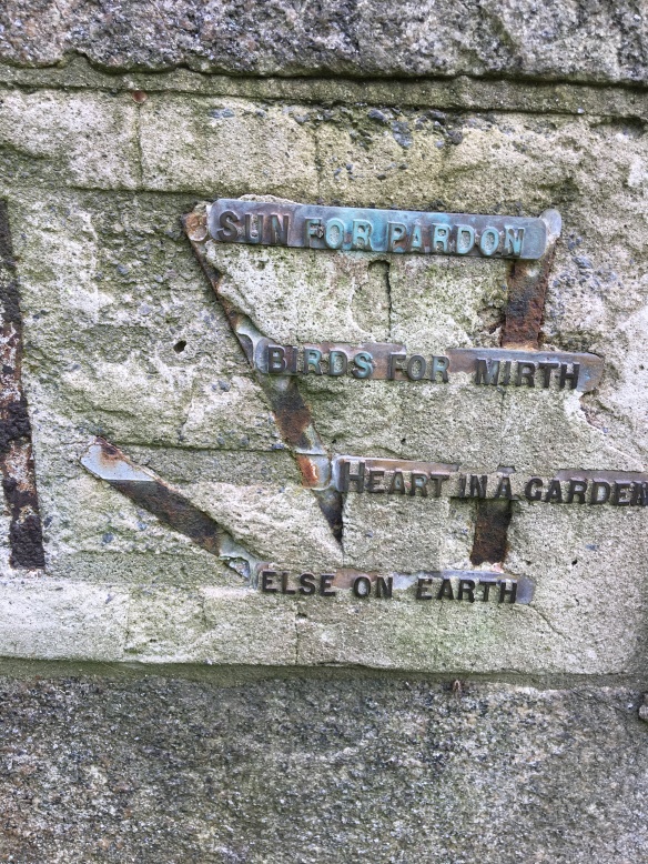
The kiss of the sun for pardon,                                                                                                     The song of the birds for mirth,                                                                                                           One is nearer God’s Heart in a garden                                                                                       Than anywhere else on earth.

The lines are from the poem “God’s Garden” by English poet Dorothy Frances Gurney (1858-1932), and are commonly found on plaques in gardens.

garden1

In 1975, the Wild Gardens reverted back to White Memorial, and the small plot of trees at the intersection of Old South and Gallows soon engulfed the monument. Recently, however, it has been been brought back into view, and while several words are missing from the poem, it remains a tribute to the splendor of the natural world that surrounds Litchfield.

Hidden Nearby: Farmington River Level Gauge in Riverton

riverton2

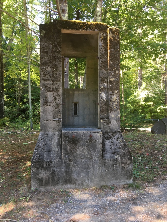
This is a remnant of one of Connecticut’s most tragic natural disasters.

The Flood of 1955’s impact on Winsted, Torrington, and Thomaston has been discussed before on this blog. Two feet of rain fell on the state, and 87 residents of Connecticut were killed. Twenty-two million dollars worth of damage were inflicted in Torrington alone.

riverton1

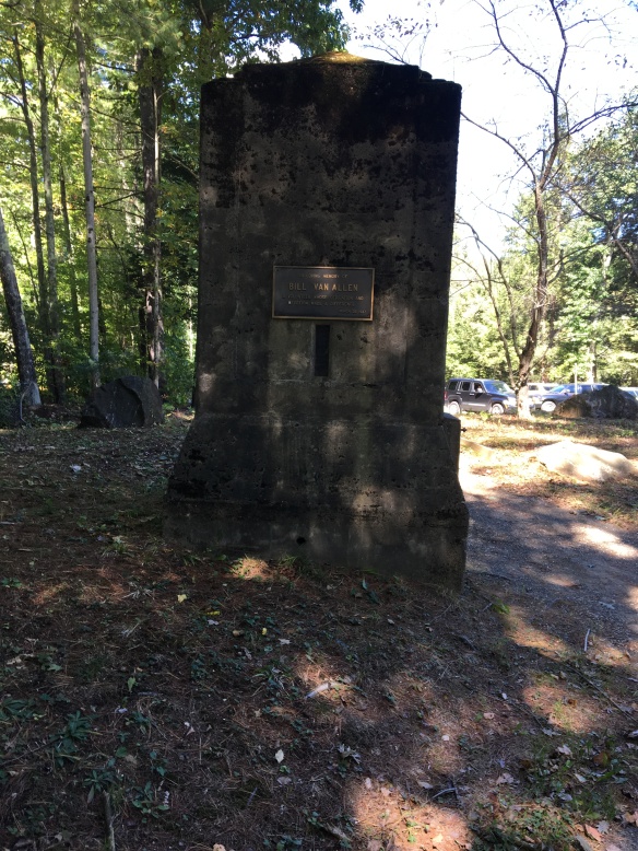
In Riverton, a cement structure that housed an apparatus to measure the depth of the Farmington River was swept away by the surging waters. It was found downstream, and brought to the local baseball fields. More than thirty years later it was adorned with a plaque honoring the memory of local volunteer Bill Van Allen.

It stands there still, a silent sentinel to the power of Mother Nature and the fury unleashed on northwestern Connecticut over sixty years ago.

Special thanks to Mike DeMazza for his help in solving the mystery of the cement structure!


Dam Remains along Butternut Brook

image

Remnants of a stone dam along Butternut Brook in Litchfield. This is a common feature on the Litchfield County landscape.

These remnants of dams are on Butternut Brook, along Duck Pond Road in Litchfield. They transport the explorer back to a time when the region’s many small industries were powered by water, an era historian Kenneth Howell has called an “empire over the dam.”

A grindstone, most commonly used in a gristmill to grind wheat into flour, or more commonly in New England to ground kernels into corn meal.

Water power was cheap and usually – except in droughts – reliable. Dams would hold back enough water to turn the water wheel, which in turn powered the drive shaft. Attached to the shaft was a vertical gear, which in turn transferred power to a horizontal gear. This, in many Litchfield County mills, turned the grindstones that turned wheat or corn into flour.

The Butternut Brook crosses Brush Hill Road (called Ripley Road on this older topographical map). The dams are located near Duck Pond Road’s intersection with Milton Road.

While Litchfield proper never saw industry rise above the level of small grist and saw mills, greater sources of water power in Milton and Fluteville (a section of town along the Naugatuck River bordering Harwinton, now lost to the Northville Dam) larger operations blossomed, powering lathes, blacksmith shops, and clock making. And of course, the dams in Northfield fueled that borough’s knife shop.

The streams of Litchfield County are dotted with hundreds of remnants of old dams, a reminder of the small industries that helped make life in this once isolated corner of Connecticut a little easier.

Look for a future post specific to Milton’s industrial heritage.

Hidden Nearby: Charles Grandison Finney’s Birthplace

Finney1

Monument at the birthplace of Charles Grandison Finney on Cunningham Road in Warren.

There were no great battles fought in Litchfield County, nor were any presidents born here. The county has, however, left an indelible mark on American history, perhaps in no area as great as in religion. The county was the home of Joseph Bellamy, Lyman Beecher, Horace Bushnell, and Michael McGivney. Another extremely prominent American religious leader who called the county home was Charles Grandison Finney, born in Warren in 1792. Finney was the youngest of fifteen children, and the family moved to upstate New York soon after his birth.

Charles Grandison Finney

Charles Grandison Finney

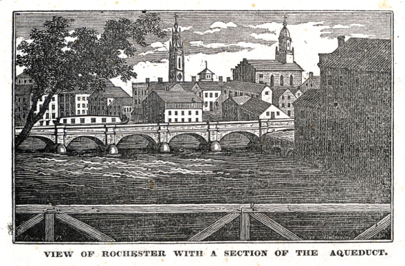
Finney has been called the “Father of American Revivalism,” and the area in western New York in which he operated became known as the “Burned-Over District” for the intensity of the religious revivals there. The high point of Finney’s revivalism was 1825-1835, and they were particularly popular in towns like Rochester that were undergoing dramatic economic transformations brought on by the opening of the Erie Canal.

Rochester, NY 1830

Rochester, NY 1830

Finney preached salvation through faith alone, but also wrote of the role of the individual’s will in achieving salvation. Finney’s religious views led him and his followers to promote social reforms, especially abolitionism and educational opportunities for women. These beliefs led him in 1835 to Oberlin College in Ohio, which accepted both genders and all races. Finney would go on to serve as the school’s president from 1851 to 1866.

Finney2

Getting to this monument is very challenging; it is advised that those seeking it walk or mountain bike down Cunningham Road. Thanks to Warren historian Ellen Paul and the dog walker I fortuitously met along Cunningham for the directions! Thanks also to Jason and Amanda McGrew for their assistance.

For more on Finney and his revivals in Rochester, see Paul Johnson’s wonderful A Shopkeeper’s Millennium: Society and Revivals in Rochester, New York, 1815-1837.

LHRR Series: The Last 1/10th Mile

Runners making the final turn from South Street to West Street experience the surge of adrenaline that comes with the wall of sound rising from the crowds along the sidewalk and the Green. The Green, the center of community activity in Litchfield, has not always been the pastoral heart of the town.

An 18th century map of Litchfield drawn by Ezra Stiles. Courtesy of Yale University.

Like many Connecticut communities, the Green began as simply a very wide road. In Litchfield, it was Meeting House Street, and was what is now East and West Streets. The western portion of this road was 264 feet wide, with the eastern portion stretching to 330 feet wide. (Colonial roads were much wider than our modern roads, in part because the lack of effective road building tools meant that large boulders and tree stumps would be left, so travelers needed ample space to get around them.) In the roadbed where Meeting House Street intersected with North and South Streets stood the Congregational Church. In 1752, the county courthouse was also built in the center of the road, and the sheep and pigs of local farms milled about.

Lyman Beecher, minister at the Litchfield Congregational Church from 1810 to 1826.

At that point the town did not have a centralized commercial district, but in the coming decades, especially during the Revolutionary War, businesses in town clustered around this intersection. An 1814 map of town shows a great deal of activity on North Street, with the courthouse having been moved to the southern side of West Street. The Congregational Church – with Lyman Beecher as minister – still stood in the intersection. This is commemorated with a monument that today is in the southern portion of the Green; there was, however, no grass there in 1814.


The Litchfield Green,. 1907.

What we would recognize as the Green began to emerge after a new Congregational Church was built outside of the intersection in 1828-29. The town decided to grade its central area to create a commons. This was divided into three sections, East, West, and Center Parks. By the time of the 1851 county centennial, this had become the major meeting place in town. The early 20th century would see transformations of the Green by Litchfield’s Village Improvement Society, but for the new sidewalks, lighting, and trees that came and went, the Green had become the heart of town, which it will be tomorrow when approximately 1,500 await the start of the 40th Litchfield Hills Road Race.

Good luck to all runners!

For more on the development of the town of Litchfield see Rachel Carley’s book Litchfield: The Making of a New England Town.

For more information on the history of the Litchfield Hills Road Race, see Lou Pellegrino’s book A History of the Litchfield Hills Road Race: In Smallness there is Beauty (now available at the Litchfield Historical Society).


LHRR Series: The Fifth Mile, Whitehall and the Chickadee Bridge

As runners pass through the gates of Whitehall, the estate of the White family, they will soon enter the race’s fifth mile. The slight downhill grade provides a respite for these runners, who will soon enter the Microwave Mile and face Gallows Lane. This wooded environment was the heart of the estate.

bw windmill

The Windmill Hill windmill (From Rachel Carley, Litchfield: The Making of a New England Town

There are many vestiges of the past splendor of these grounds. The shingled building to the right was the family’s carriage house. From here, they traversed the miles of carriage roads that crossed their thousands of acres. The hill behind the carriage house is Windmill Hill, so named for the wind-powered pump that filled a cistern to provide water to the home. This hill was also the site of exotic tree plantings by the family, who planted over one million trees on their estate.

Whitehall (Courtesy of White Memorial Foundation)

The current visitor’s center was Whitehall, the seat of the estate. John Jay White moved his family here following the New York City draft riots in 1863. Alain went on to study botany at Harvard, and became a master chess player, a skill that led to his recruitment as a cryptographer during World War I. May’s philanthropic spirit centered on bringing children from New York City to Litchfield for summers. The family home was designed in quintessential Victorian style, with garrets, a tower, and many chimneys. The structure underwent extensive renovations when it became the center of the White Memorial Foundation.

Note the tree stump on the right side of the image. (Courtesy of the White Memorial Foundation)

Across the street from the visitor center is a concrete tree stump, a reminder of earlier days when this area was the scene of picnics and even duck pin bowling, on an alley painstakingly leveled by Alain White for the use of the Sanctum club.

Chickadee Bridge (Courtesy of White Memorial Foundation)

A notable feature of the race for runners is crossing the Bantam River on the Chickadee Bridge. This bridge allowed the Whites to access their carriage roads on the east side of the river. The shoreline is now covered with trees, rendering this view impossible. The Whites often called this Silver Bridge, and noted that it was the farthest up the river that motorboats could venture; today, the presence of beaver dams makes this also impossible. The Chickadee Bridge stands as a reminder to runners that while they here turn back toward Litchfield, their journey is going to get much more difficult.

For more information on the history of the Litchfield Hills Road Race, see Lou Pellegrino’s book A History of the Litchfield Hills Road Race: In Smallness there is Beauty (now available).

Land Conservation in Litchfield County

There were more trees in Connecticut in 2010 than there were at any time since 1850. This, of course, reflects different land use patterns that have emerged as the state’s economy has evolved. In Litchfield County this is also a result of the willingness of residents to conserve rather than develop their land.

Roxbury

The Orzech Family Preserve, 112 acres near Route 67 and the Shepaug River in Roxbury.

The celebrities and artists who have long been attracted to the area have also been prominent supporters of land conservation, and nearly every town in the county has a land trust.  Some of these trusts are extraordinarily active; the Weantinoge Heritage Land Trust, for example, has preserved over 4,000 acres of land, mostly in Litchfield County.  The results of this movement have been profound. Perhaps the best example comes from George Black’s book, The Trout Pool Paradox, in which he laments the Naugatuck River south of Torrington as a “chemical sewer,” while the Shepaug River is the “Platonic ideal of a trout stream.”

IMG_2920

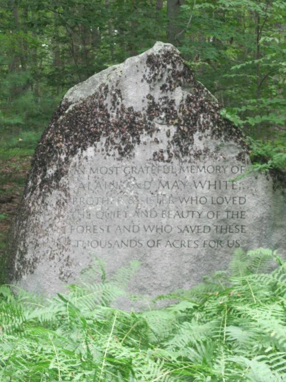
This carving on a boulder in the White Memorial Foundation honors Alain and May White.

Alain and May White were among the most extraordinary conservationists in the county. In addition to their own 4,000 acre preserve (what is now the White Memorial Foundation), the siblings additionally donated nearly 6,000 acres to fourteen Connecticut state parks, mostly in Litchfield County.

marcicostas

The Macricostas Preserve of Steep Rock, along Route 202 in Washington.

A similar operation to the Whites was taking place in Washington, where noted architect Ehrick Kensett Rossiter made the Steep Rock Land Trust his most lasting legacy to the town.  Rossiter began with a 100-acre purchase in 1881 – what would become the heart of the preserve – and continued to add land to the trust he established. Additional donations from the Van Sinderen and Macricostas families have brought Steep Rock’s holdings to nearly 3,000 acres.


Daffodils

The Morosani Preserve in Northfield.

The examples of the Whites and Rossiter are matched in spirit if not in size by dozens of more conservationists who have helped to preserve the county’s landscape.  Among these are the Morosanis, whose Laurel Ridge Foundation is noted for its daffodils every spring, Edith Morton Chase, daughter of a brass magnate whose home became Topsmead State Forest, and S. Dillon and Mary Livingstone Ripley, whose Kilvarock estate became the Livingstone Ripley Waterfowl Conservancy.


The Girl Scouts’ Camp Townshend


ctcabin

One of the remnants of Camp Townshend cabins

Beyond the White Memorial Foundation, Alain and May White contributed money and land to dozens of other ventures that have greatly impacted the Litchfield County landscape.   Among these are the Connecticut State Police barracks in Litchfield, Community Field, the land for Litchfield Intermediate and High Schools, Wamogo Regional High School, and the Bantam Civic Association.  They also donated 5,745 acres to 14 Connecticut state parks, most in northwestern Connecticut.

latrine

A latrine

The Foundation supported the Boy Scouts by leasing Camp Boyd, adjacent to Sandy Beach (the cabin burned in the 1970s) and the Girl Scouts through Camp Townshend, located along Alain White Road in Morris. Townshend opened in 1940, and by the end of that decade over 700 campers visited the property. The property could house 100 campers and 28 staff members for each two-week camp session, which began in late June.   In the late 1940s and early 1950s, Mrs. Barbara Cutler served as camp director, and the facility was overseen by a 22-member Budget, Planning, and Maintenance Committee.

cabin interior

The interior of a cabin. The writing on the wall says “Cloud, Lightning, Sun, Moon, Star, Rainbow, Rainbow, Bean Sprout, Corn, Blossom, Warrior Mark, Mark of Some Offices”

telephone

Remnants of old telephones?

While Camp Townshend closed in the mid-1970s, and was utlized by the Morris and Litchfield fire departments for  training exercises, a walk through the remains of Camp Townshend has the feel of visiting a Wild West ghost town. Even in the darkest days of fall and winter, it is easy to imagine the sounds of summer coming from the lake.

shore

The Camp Townshend shore line