Hidden Nearby: An Autumn Walk to Steep Rock’s Quartz Mine

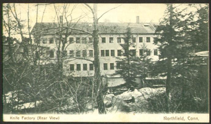
As with many of our other protected lands (Lover’s Leap State Park, Burr Pond State Park, the White Memorial Foundation), the Hidden Valley Preserve of Washington’s Steep Rock Association was once the site of industrial operations. The Hidden Valley, quiet today except for the sound of the rushing Shepaug River, once echoed with the sounds of quartz mining and locomotives. The glories of a New England Fall presents the perfect time to visit this piece of Litchfield County’s industrial heritage.

IMG_6713

A short walk along the northwestern bank of the river brings the hiker to the spectacular Thoreau Bridge, erected in 2015.

IMG_6683

Quotes from Thoreau are emblazoned on the bridge.

IMG_6704

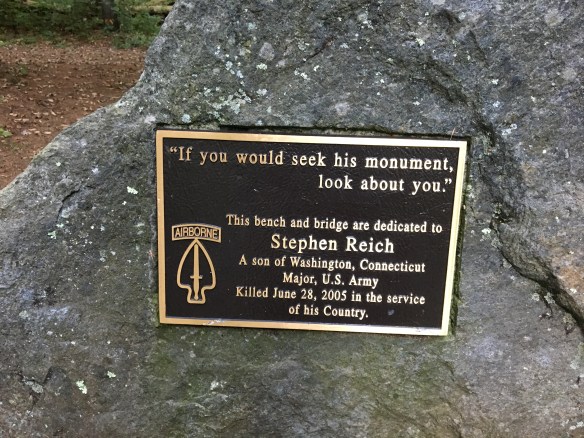
On the eastern bank of the Shepaug River is this monument and bridged dedicated in honor of Washington native and West Point graduate Stephen Reich, killed in Afghanistan in 2005. 

IMG_6700

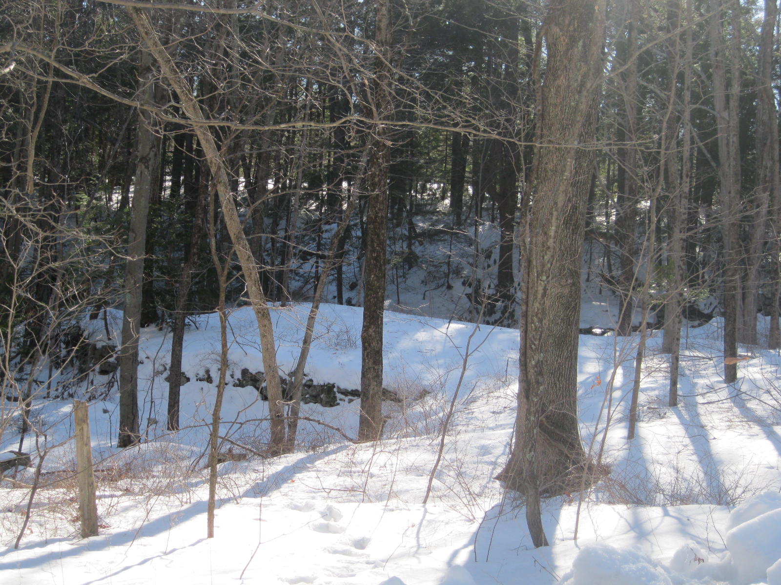
The trail passes old footpaths, cart paths, and the bed of the railroad used to haul the quartz out of the area, often to the Hudson River.

IMG_6707

Stone retaining walls in the woods mark the old road beds used to get wagons and carts to the mine.

IMG_6708

Fragments of quartz line the trail approaching the mine.

IMG_6709

The quartz itself, a surface mine in operation from the 1800s to 1905.


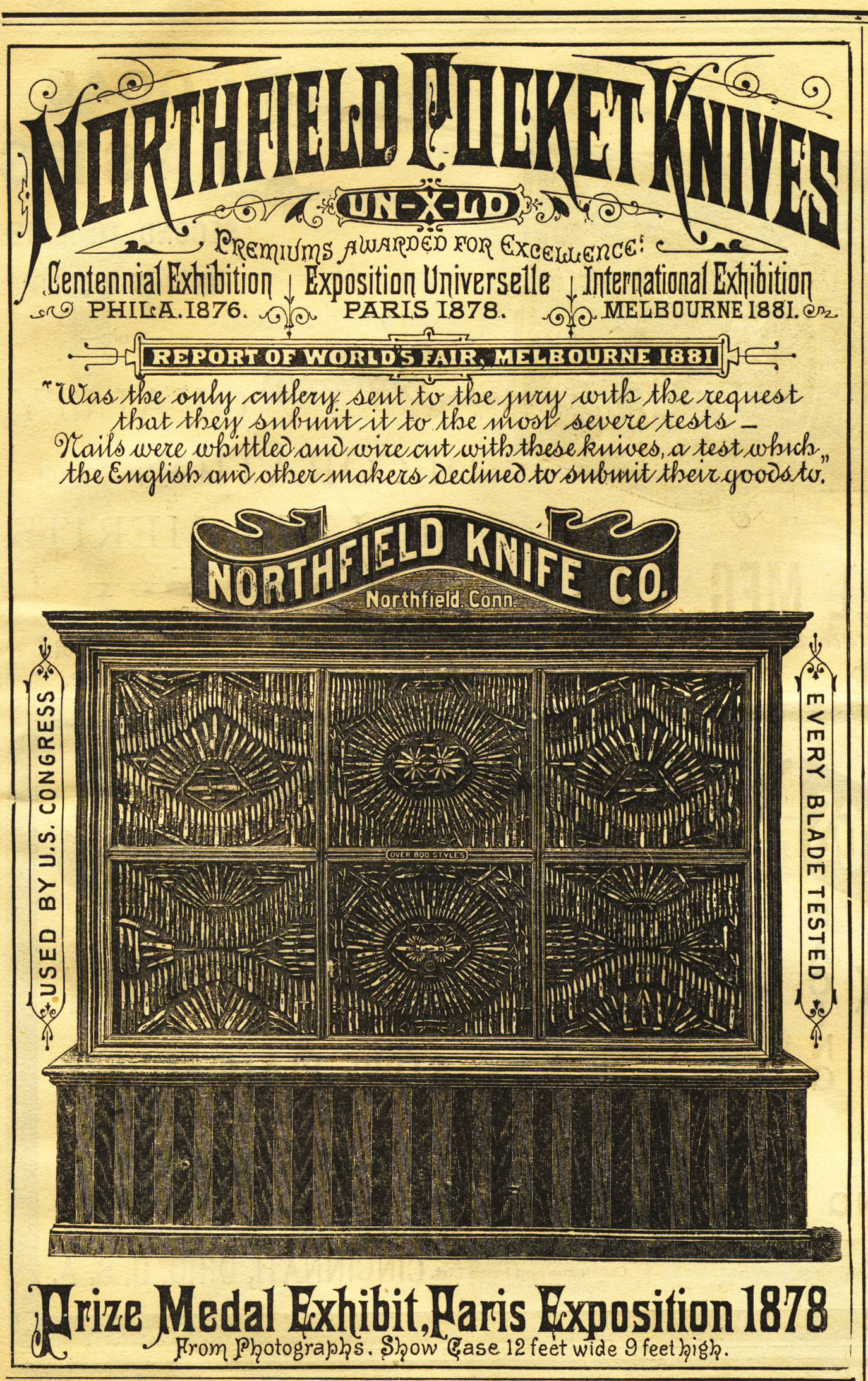
Quartz, the most common mineral on the earth’s surface, was an important industrial product in American history. Initially quartz was used for knives, scrapers, and arrowheads. With the coming of the industrial revolution, the uses of quartz changed. It was pulverized and used as a filler in paints. (The Bridgeport Wood Finishing Company, a major paint-making operation, was located just a few miles away along the Housatonic in New Milford.) Another use of quartz was as an abrasive, like sandpaper. The primary use of quartz, however, was for glass, which is essentially melted quartz.


The hiker needs no excuse to travel to the beautiful woods of the Hidden Valley, but keeping one’s eyes open reveals a rich part of the county’s history.


Dam Remains along Butternut Brook

image

Remnants of a stone dam along Butternut Brook in Litchfield. This is a common feature on the Litchfield County landscape.

These remnants of dams are on Butternut Brook, along Duck Pond Road in Litchfield. They transport the explorer back to a time when the region’s many small industries were powered by water, an era historian Kenneth Howell has called an “empire over the dam.”

A grindstone, most commonly used in a gristmill to grind wheat into flour, or more commonly in New England to ground kernels into corn meal.

Water power was cheap and usually – except in droughts – reliable. Dams would hold back enough water to turn the water wheel, which in turn powered the drive shaft. Attached to the shaft was a vertical gear, which in turn transferred power to a horizontal gear. This, in many Litchfield County mills, turned the grindstones that turned wheat or corn into flour.

The Butternut Brook crosses Brush Hill Road (called Ripley Road on this older topographical map). The dams are located near Duck Pond Road’s intersection with Milton Road.

While Litchfield proper never saw industry rise above the level of small grist and saw mills, greater sources of water power in Milton and Fluteville (a section of town along the Naugatuck River bordering Harwinton, now lost to the Northville Dam) larger operations blossomed, powering lathes, blacksmith shops, and clock making. And of course, the dams in Northfield fueled that borough’s knife shop.

The streams of Litchfield County are dotted with hundreds of remnants of old dams, a reminder of the small industries that helped make life in this once isolated corner of Connecticut a little easier.

Look for a future post specific to Milton’s industrial heritage.

Hidden Nearby: The Throop Family Enterprises Marker in Morris

IMG_3401In the last post we examined the Loveland/King grist mill that once stood along Route 109 east of Morris.  This marker, a plaque attached to a millstone, sits along Route 109 west of Morris and denotes the site of another industrial operation.  Here the Throop family engaged in a variety of enterprises, most centered around milling.

photo (22)

The Throop Mill, located on the south side of Route 109, where its foundation is still visible. In addition to cider, the mill made shingles and operated as a grist mill for flour. Courtesy Morris Historical Society.

Little information is available about the Throops.  This marker, however, gives an insight into an interesting aspect of Connecticut’s early economy, cider making.  Cider was an important outlet for farmers to turn a perishable product into a lasting one.  Once it was barreled cider was also easy to transport to markets.  Recipes for cider were widespread in the 19th century, with most farmers having their own method.  Some advocated cleaning the press, others recommended using the residue from previous batches to add flavor.  While some recipes called for unripe apples, others used rotten apples.  Some even called for grass to be mixed with the apples.  Cider in the colonial era and the early republic was nearly always hard, and as the alcohol level was quite low was enjoyed by children and adults alike.

wpressx Apples were ground before pressing.  These ground apples would be placed in a bucket, underneath a wooden disc attached to a screw.  By turning the screw the disc would exert pressure on the apples, turning them into liquid and pulp.  Often the press would double as a cheese press.

photo (21)

Mill Pond, also known as Throop Pond or Jones Pond. The water from this pond was used to power many of the small industries operated by the Throops. Courtesy of the Morris Historical Society.

Cider making was immensely popular on Litchfield County farms.  Records from Torrington indicate that in 1775, the population of 843 people produced approximately 1500 barrels of cider.  There were two cider major cider producers in Morris (then South Farms) – the Harrison family in addition to the Throops.  Litchfield County also had 103 distilleries in 1810, many of which made apple beverages of higher alcohol content.  By means of comparison, New Haven and Tolland counties together had 101 distilleries.

photo (20)

The Throop house, which burned in 1914. Courtesy of Morris Historical Society.

In recent years small batch production of agricultural products has once again become fashionable.  Syrup, honey, and jams are mainstays at farmers’ markets.  The popularity of these items harkens back to a time when local production of items like cider was not simply in vogue, but rather a way of life.

For information on cider making in early New England, see “New England Cider Mills, Distilleries, and Breweries, 1790–1840” by Roger N. Parks and Sylvie Turner.  Available on the Old Sturbridge Village website, http://www.osv.org/explore_learn/document_viewer.php?Action=View&DocID=1005

Hidden Nearby: The King Grist Mill Marker in Morris

IMG_3281This monument, difficult to see as cars speed along Route 109 in Morris, marks the site of the King Family Grist Mill.  The grist mill was once a vital part of New England communities.  While we usually associate grist mills with grinding wheat into flour, that was not typically the case in New England.  Here, with our rocky soil, it was far more common for farmers to raise rye, corn and buckwheat to be milled.  In fact, white bread was considered to be a luxury.

Kings_Mill_on_the_Morris_Road

An undated image of King’s Grist Mill. Courtesy of the Connecticut Historical Society.

This particular grist mill, likely built in the 1830s, was initially run by the Loveland family, who operated the mill in Morris (then called South Plains) for nearly fifty years before it was taken over by the Kings.  In addition to grinding grains, the families also utilized water power to saw timber and for the fulling (cleaning)of cloth.  The mill was described by Marilyn Nichols (who wrote its history, likely around 1905) as being “one of the old landmarks and one of the more generally known throughout Litchfield County and other sections of the state.”  Nichols described its location as being “in one of the most romantic and beautiful valleys of Connecticut.”  In fact, Nichols wrote of one local artist who gained distinction – and $400 – by selling a painting of the mill at a New York studio.

100_3892_250x397-6sec

Diagram explaining the workings of a grist mill. Courtesy of National Park Service.

The Loveland/King mill utilized two circular stones to grind.   Traditionally, both stones would have grooves cut into them to act as teeth.  The grains would be poured over the bottom stone while water power was used to turn the top stone, grinding the grain into flour.  One bushel of grain typically yielded 35 pounds of flour.   Johnnycake was the most expensive product of the mill, as it required a special bolt made from silk, and it was a particular target of hungry mice.

ct_waterbury02

The milldam for the Loveland/King grist mill was destroyed to help create the Wigwam Reservoir for the city of Waterbury.

Farmers would bring their grains to the mill, and the milling usually took place while the farmer waited.  The Lovelands were known to operate their mill until midnight to accommodate the farmers.  Millers usually received a percentage of the grain as payment, and mills often served as commodity houses where grains and flour were traded.

IMG_3282Elijah King took possession of the grist mill sometime before 1874, and while he ran it successfully for some years, changes in farming techniques and the decline of old milling practices left him bankrupt.  In fact, the prevalence of wheat flour from the Midwest and the advent of gasoline-powered engines to mill grains on the farm for animal consumption prompted Nichols to write, “obsolete is the old grist mill in Connecticut.”  Few remnants of grist mills are visible in the state, and the only trace of the Loveland/King mill, once a vital part of the local economy in Litchfield County, is the marker placed by the King family along Route 109.

Update:  Below are two maps depicting the mill.  The first is Clark’s 1859 map designating the mill as Loveland’s mill.  The second is Beers’ 1874 map, showing that King owned the mill at that point.  Note also the numerous structures in the area compared to today.

Morris Detail

Clark’s 1859 map

MorrisDetail_Beers

Beers’ 1874 map. Thanks to Linda Hocking of the Litchfield Historical Society for supplying the images of these maps!

Much of this information came from Marilyn Nichols’ lecture, available at:  “Old Grist Mills Cease” (2010-367-0) Litchfield Historical Society, Helga J. Ingraham Memorial Library, P.O. Box 385, 7 South Street, Litchfield, Connecticut, 06759

The Northfield Knife Shop

knife shop dam

A recurring theme of this blog has been that street names have a lot to tell us.

Mill pondSuch is the case with Northfield’s Knife Shop Road.  Here, on the Humiston (or Humaston) Brook mill pond, once stood Litchfield’s largest business.

Northfield_Knife_Factory_Northfield_CT-690x405The Northfield Knife Company was established in 1858, taking advantage of the water power and access to the Naugatuck Railroad.  In the post-Civil War era the company produced over 12,000 knives per year.

000_2242It employed 120 workers, many of whom were highly trained experts from Sheffield, England, then world-renown for its excellence in steel-knife production.  (In fact, when a proposal was made in 1866 to incorporate Northfield as a separate town, one opponent argued before the state legislature that the English cutlers weren’t fit to be citizens of a town!)

foundation

Foundation of the the knife shop complex.

The mill dam brought other businesses to Northfield as well, most prominently a feed and fertilizer mill run by Jeremiah Peck.  The growth of these two businesses led to a corresponding growth in Northfield’s population, and factory housing appeared in town.  In 1865, for example, the Northfield Knife Company spent $5,000 to erect five homes for employees on Main Street.

northfieldknifeoct41884ironageadNorthfield knives live on as Northfield UN-X-LD, a division of Great Eastern Cutlery.  Today they are made in Titusville, Pennsylvania.  The mill pond in Northfield remains, however, testimony to the industrial heritage of this area and to the Northfield Knife Company, an internationally-known business whose knives were featured at the 1893 World’s Columbian Exposition in Chicago.

Much of the information presented on Northfield’s industrial history is derived from Rachel Carley’s excellent  Litchfield:  The Making of a New England Town.