Dam Remains along Butternut Brook

image

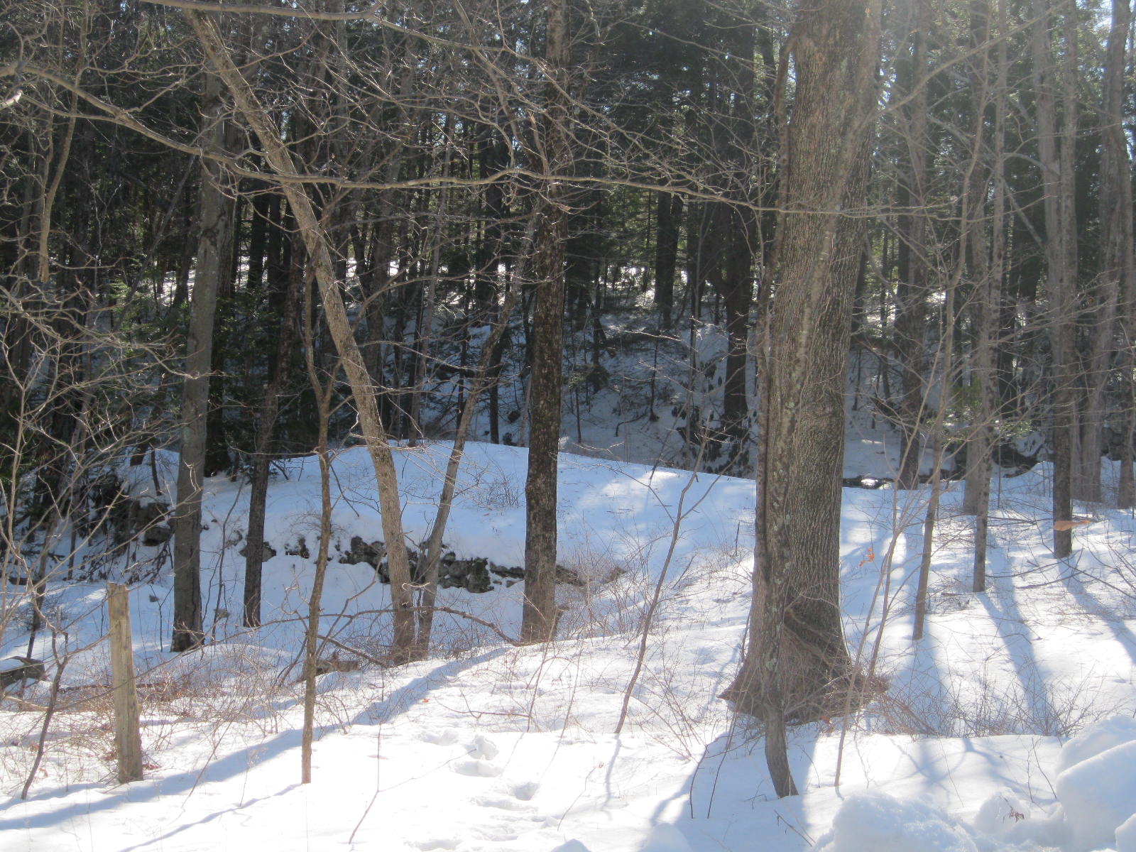
Remnants of a stone dam along Butternut Brook in Litchfield. This is a common feature on the Litchfield County landscape.

These remnants of dams are on Butternut Brook, along Duck Pond Road in Litchfield. They transport the explorer back to a time when the region’s many small industries were powered by water, an era historian Kenneth Howell has called an “empire over the dam.”

A grindstone, most commonly used in a gristmill to grind wheat into flour, or more commonly in New England to ground kernels into corn meal.

Water power was cheap and usually – except in droughts – reliable. Dams would hold back enough water to turn the water wheel, which in turn powered the drive shaft. Attached to the shaft was a vertical gear, which in turn transferred power to a horizontal gear. This, in many Litchfield County mills, turned the grindstones that turned wheat or corn into flour.

The Butternut Brook crosses Brush Hill Road (called Ripley Road on this older topographical map). The dams are located near Duck Pond Road’s intersection with Milton Road.

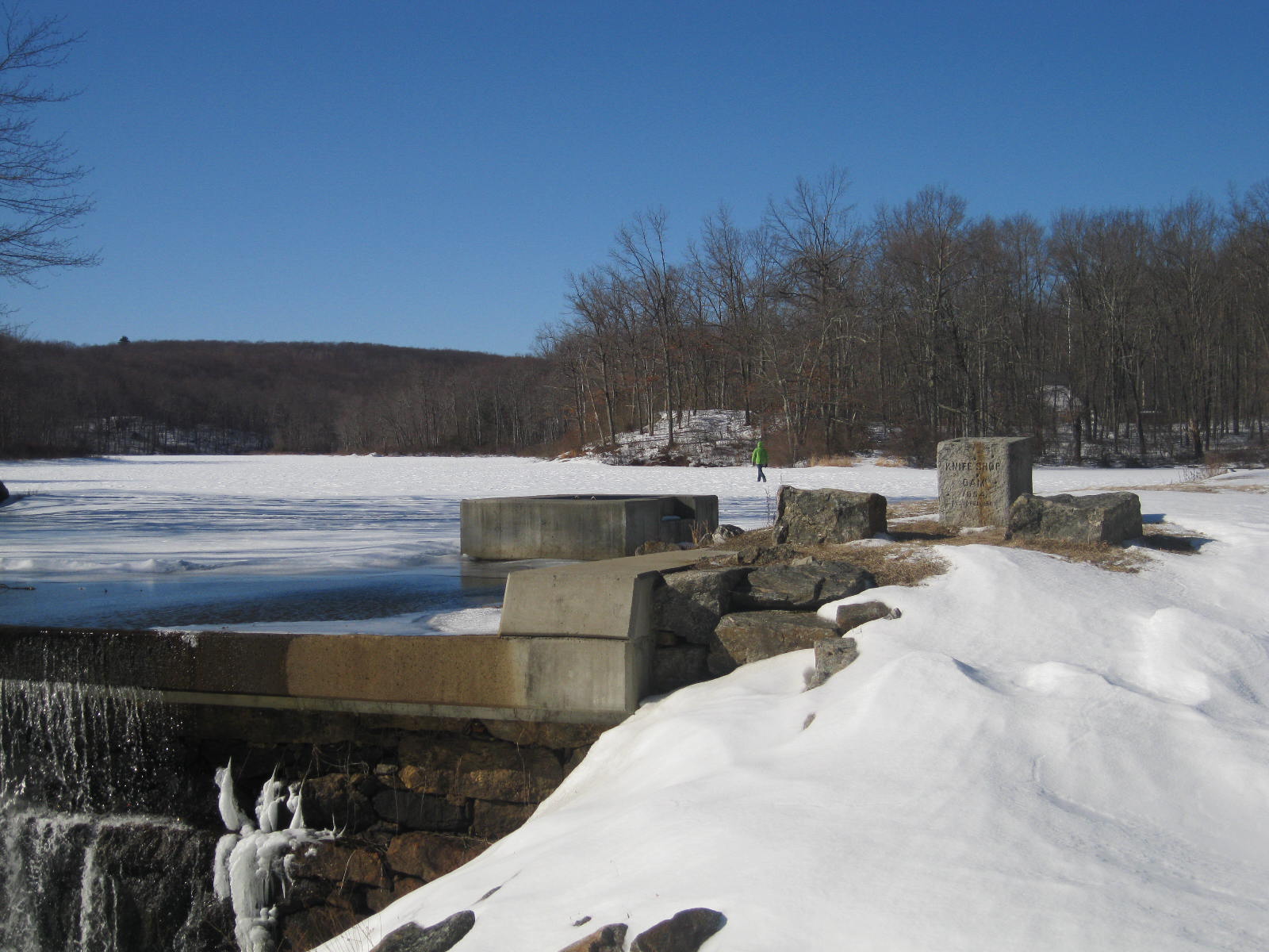
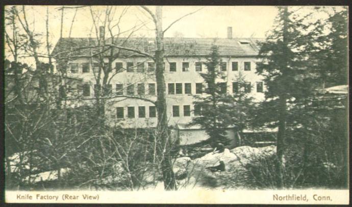
While Litchfield proper never saw industry rise above the level of small grist and saw mills, greater sources of water power in Milton and Fluteville (a section of town along the Naugatuck River bordering Harwinton, now lost to the Northville Dam) larger operations blossomed, powering lathes, blacksmith shops, and clock making. And of course, the dams in Northfield fueled that borough’s knife shop.

The streams of Litchfield County are dotted with hundreds of remnants of old dams, a reminder of the small industries that helped make life in this once isolated corner of Connecticut a little easier.

Look for a future post specific to Milton’s industrial heritage.

Advertisement

60 Years Ago: The Flood of 1955

The Prospect Street bridge over the Naugatuck River in Torrington (Connecticuthistory.org)

The Prospect Street bridge over the Naugatuck River in Torrington (Connecticuthistory.org)

The Flood of 1955, the worst natural disaster in Connecticut history, resulted from the approximately two feet of rain dropped by Hurricanes Connie and Diane that August. Low-lying areas were already flooded on the morning of August 18th when the second storm dumped fourteen more inches that afternoon and on August 19th. The Housatonic stood at 24.5 feet deep and the Mad and Still Rivers in Winsted raged at 50 miles per hour.  In Torrington, the Naugatuck River, so peaceful looking today, swept away lumber, rocks, even buildings. Stores along East Main Street were filled with six feet of water. The city suffered an estimated $22 million dollars in damage.

Memorial to flood victims in Winsted

Memorial to flood victims in Winsted

A similar scene played out in Winsted, while the Shepaug River carried away an apartment building in Washington Depot.  Concrete sections of Route 44 were washed away and across the county, Bailey bridges – made famous during World War II – were used to provide temporary river crossings.  Twenty-five helicopters searched for survivors or dropped clean food and water.  Statewide, 87 people were killed, and over 8,000 buildings were damaged or destroyed. Twenty five of the dead were from Litchfield County. Memorials stand in Torrington and Winsted to those who lost their lives.

American Brass factory, Torrington

American Brass factory, Torrington

Extraordinary acts of heroism by police, firemen, and ordinary citizens kept the death toll from growing. In its August 26th, 1955 edition the Torrington Register proclaimed, “So numerous were the many acts of heroism, rescue of the sick and invalid, neighbors’ concern for neighbors, that it would impossible to chronicle them without slighting someone deserving of great credit.

dam

Thomaston Dam

In addition to severely (in some places irreparably) damaging the state’s industrial infrastructure, the floods forced the Army Corps of Engineers to take action so that such a disaster never happened again.  The army constructed the Thomaston Dam (1960), Northfield Brook Dam (1965), and Colebrook Dam (1969), at a cost of $70 million.  The Naugatuck River, with its many tributaries, had been especially prone to flooding and the dams constructed along that river provided over 77,000 acres of flood capacity, while returning over 1,000 acres to forest.  This protection came at a price as construction displaced the communities of Fluteville and Campville in Litchfield.  Still, it is perhaps fortunate that the traveler through Torrington today has difficulty in imagining the destructive power of the now-controlled Naugatuck River. 

Please see “The Lost,” a special section of the Hartford Courant for tributes to those who died in the Flood of 1955: http://www.courant.com/news/connecticut/hc-55flood-casualties-htmlstory.html

Also see the Torrington Register-Citizen’s photo archive of the flood: https://picasaweb.google.com/lh/albumMap?uname=kaitlynmyeager&aid=5547678124797887025#map

The Northfield Knife Shop

knife shop dam

A recurring theme of this blog has been that street names have a lot to tell us.

Mill pondSuch is the case with Northfield’s Knife Shop Road.  Here, on the Humiston (or Humaston) Brook mill pond, once stood Litchfield’s largest business.

Northfield_Knife_Factory_Northfield_CT-690x405The Northfield Knife Company was established in 1858, taking advantage of the water power and access to the Naugatuck Railroad.  In the post-Civil War era the company produced over 12,000 knives per year.

000_2242It employed 120 workers, many of whom were highly trained experts from Sheffield, England, then world-renown for its excellence in steel-knife production.  (In fact, when a proposal was made in 1866 to incorporate Northfield as a separate town, one opponent argued before the state legislature that the English cutlers weren’t fit to be citizens of a town!)

foundation

Foundation of the the knife shop complex.

The mill dam brought other businesses to Northfield as well, most prominently a feed and fertilizer mill run by Jeremiah Peck.  The growth of these two businesses led to a corresponding growth in Northfield’s population, and factory housing appeared in town.  In 1865, for example, the Northfield Knife Company spent $5,000 to erect five homes for employees on Main Street.

northfieldknifeoct41884ironageadNorthfield knives live on as Northfield UN-X-LD, a division of Great Eastern Cutlery.  Today they are made in Titusville, Pennsylvania.  The mill pond in Northfield remains, however, testimony to the industrial heritage of this area and to the Northfield Knife Company, an internationally-known business whose knives were featured at the 1893 World’s Columbian Exposition in Chicago.

Much of the information presented on Northfield’s industrial history is derived from Rachel Carley’s excellent  Litchfield:  The Making of a New England Town.