Stone Walls

DSC_1017

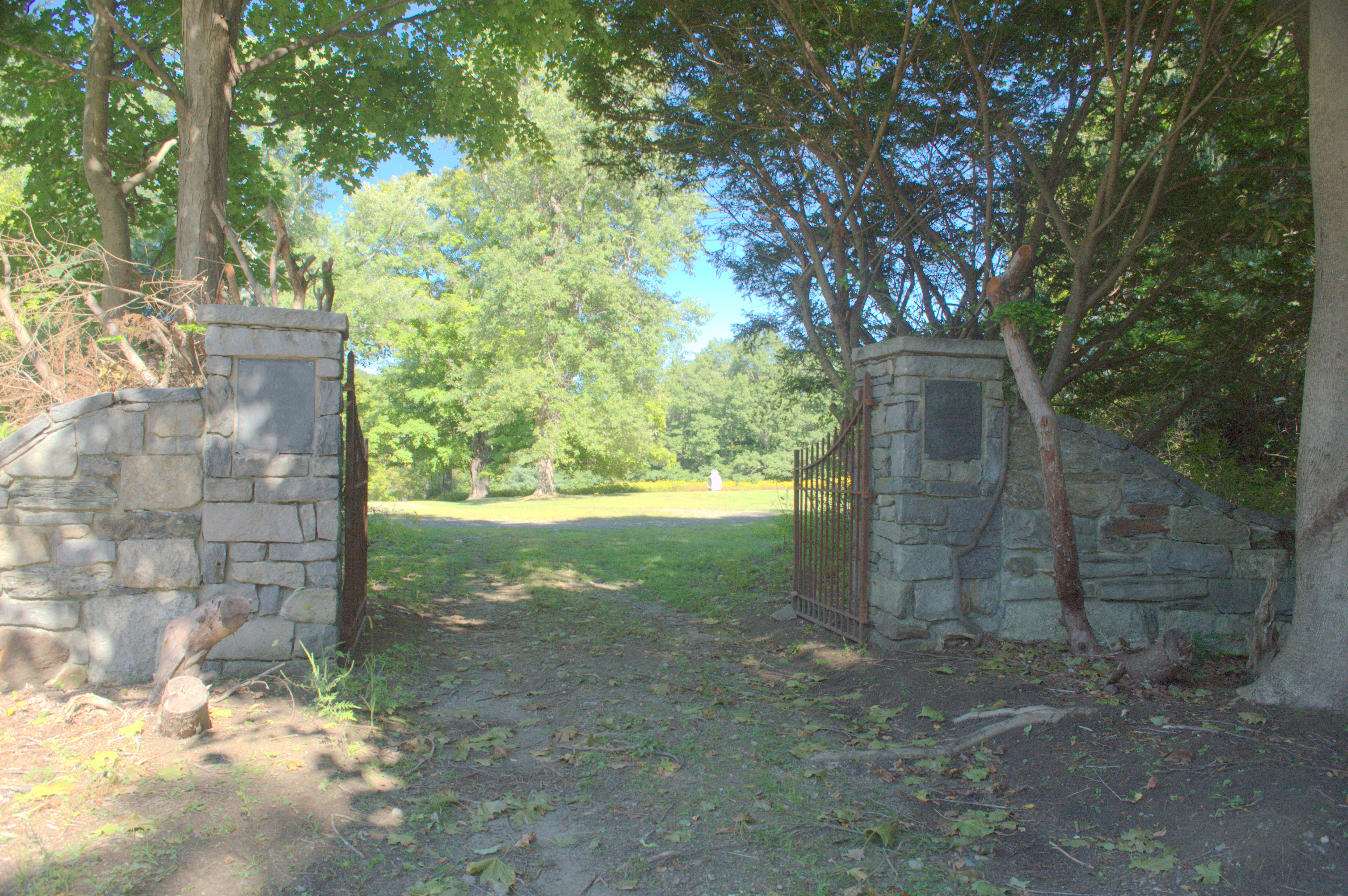
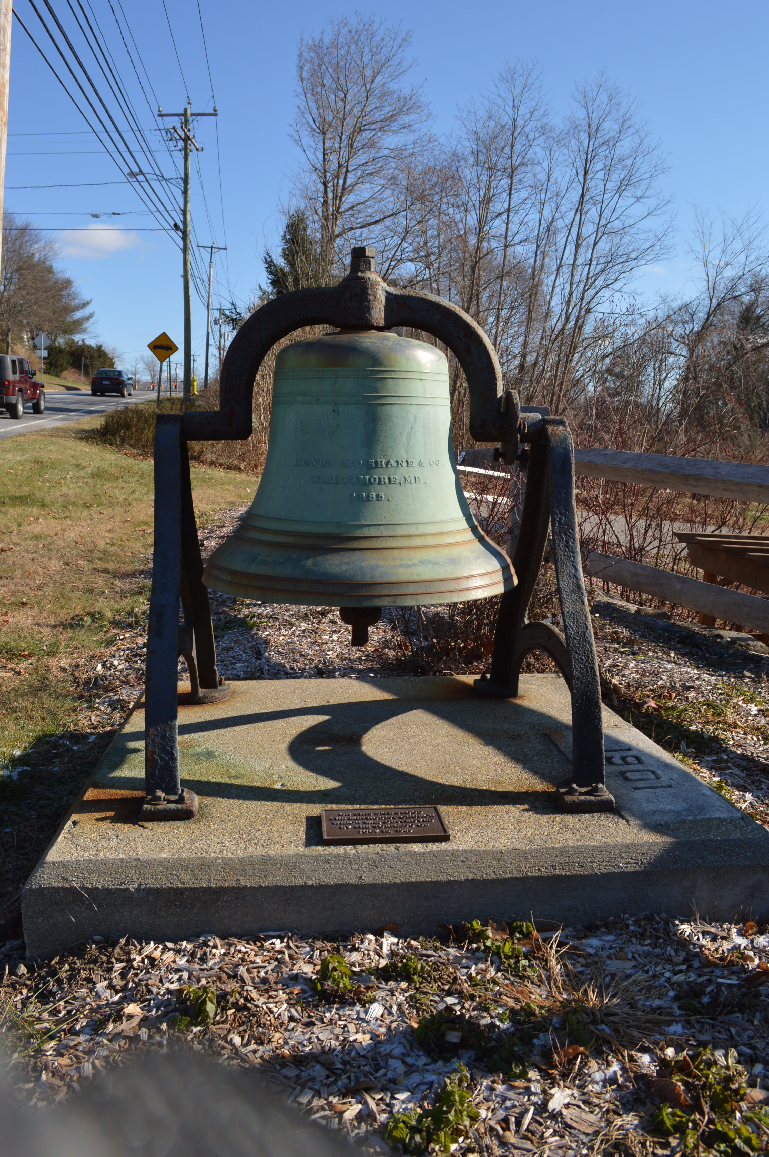
With the leaves off the trees fall is a great time to explore the stone walls of White Memorial. There is, perhaps, no better-known example of man’s reshaping of the Litchfield County landscape than stone walls. Robert Thorson, author of the superb history of these creations, Stone by Stone, wrote that “abandoned stone walls are the signatures of rural New England, the “relics of a vanished agricultural civilization.”

Perhaps there is no better metaphor for the history of Litchfield County than its ubiquitous stone walls. Constructed from colonial times through the middle of the nineteenth century, they stand as testimony to the intrepid early settlers who cleared the land in the hopes of making a living from the county’s soil. In plowing their fields, they utilized these unwanted stones to dam streams, mark roadways and property boundaries and pen in livestock. Yet the explorer is struck to find these vestiges of an earlier time in the county’s deepest forests, an indication that this land was once cleared and worked but has since been reclaimed by forests as lifeways in the county changed.

DSC_1015

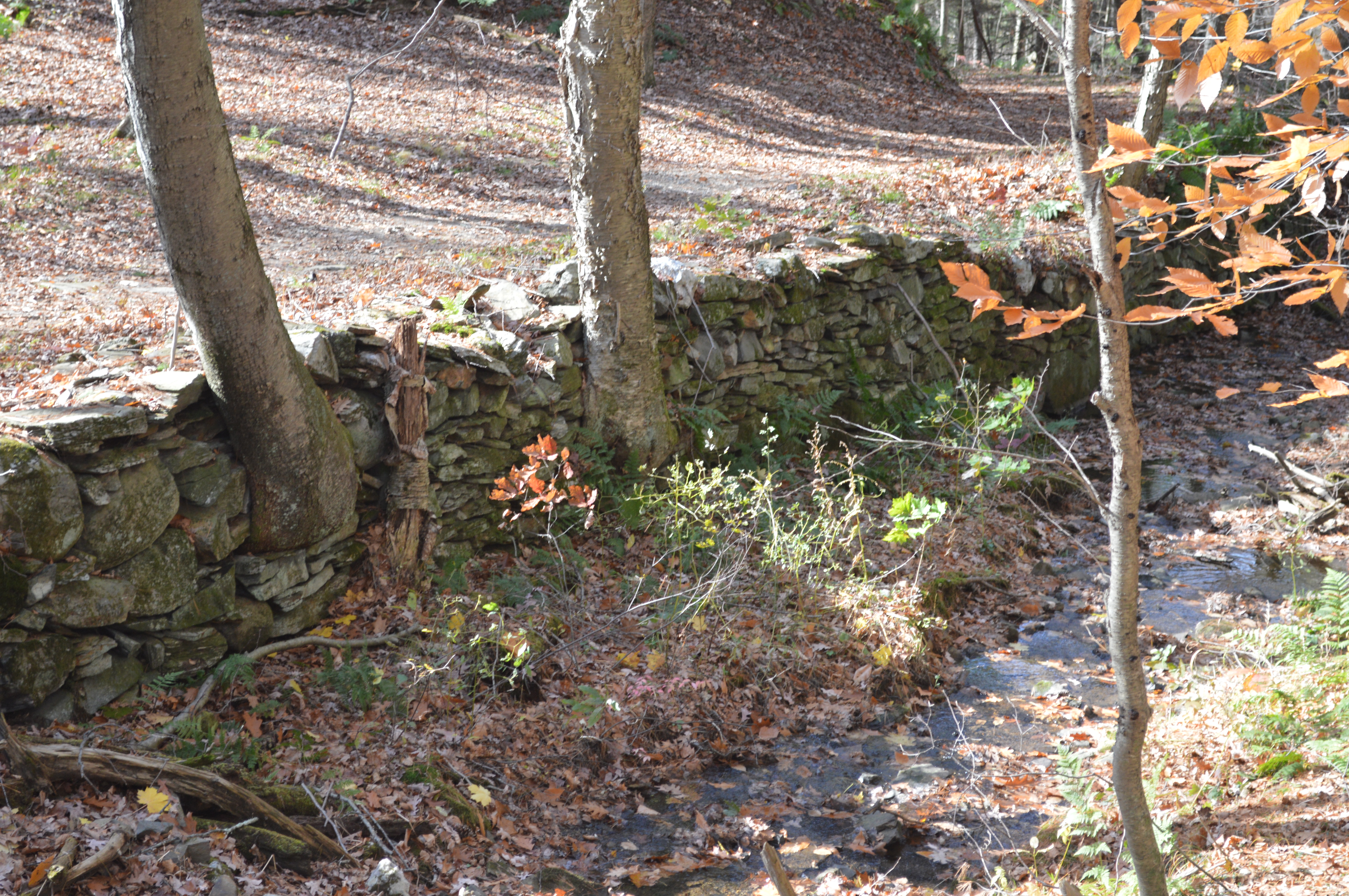
The stones that form these walls were deposited by the Laurentide Ice Shield 15,000 to 30,000 years ago, which scraped down to New England’s bedrock and scattered billions of stones across the region. Initially, the earliest stonewalls were built from stones obtained from quarries. The “Little Ice Age” of the 18th century, however worked stones to the surface through deep freezes and the erosion caused by spring runoffs. Thus, the clearing of stones from pastures and fields became an annual spring ritual. Farmers brought these stones to the fences that lined their properties, often by hand or by sleds pulled by oxen. Over time, these piles were reworked into more architecturally-significant structures as the supply of labor on farms grew.  Eventually the walls shaped the landscape by forcing rain to different streams or building up soils.

DSC_1033

Stone walls served several purposes for farmers. When the communal land practices of the earliest colonial days shifted to a philosophy of individually owned land, stone walls were used to define boundaries. Farmers often piled stones until they reached the lowest level of a split rail fence.  Stone pens were utilized for what Thorson has termed the “strategic dropping of manure” for use as fertilizer. Elaborate stone walls were utilized as status symbols. More than anything, however, stone walls were simply ways to dump stones that were obstacles to farmers in their fields.

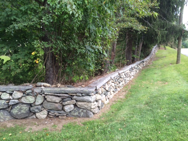
New England farmers built five principal types of stone walls. These are:

DSC_1014

Dumped Wall – A simple line of piled stones.

DSC_1026

Tossed Wall – With stones stacked like firewood, this is the most common of       stone walls. It required a bit more attention that the dumped wall.

DSC_1023

 Single Wall – stones piled on top of each other. These were used to surround pastures.

DSC_1011

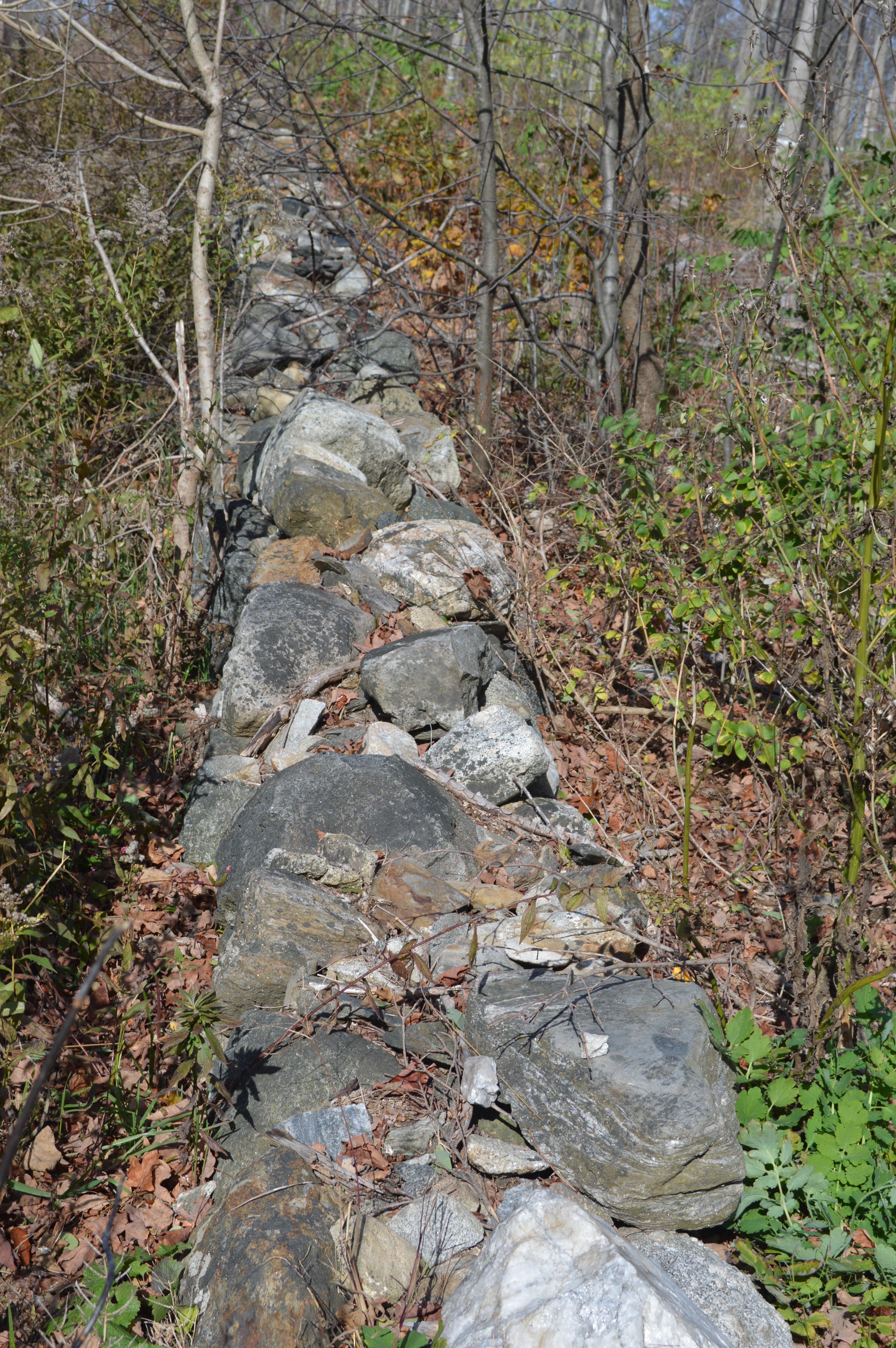
Double Wall – Parallel walls with smaller stones used to fill in between.

DSC_1028

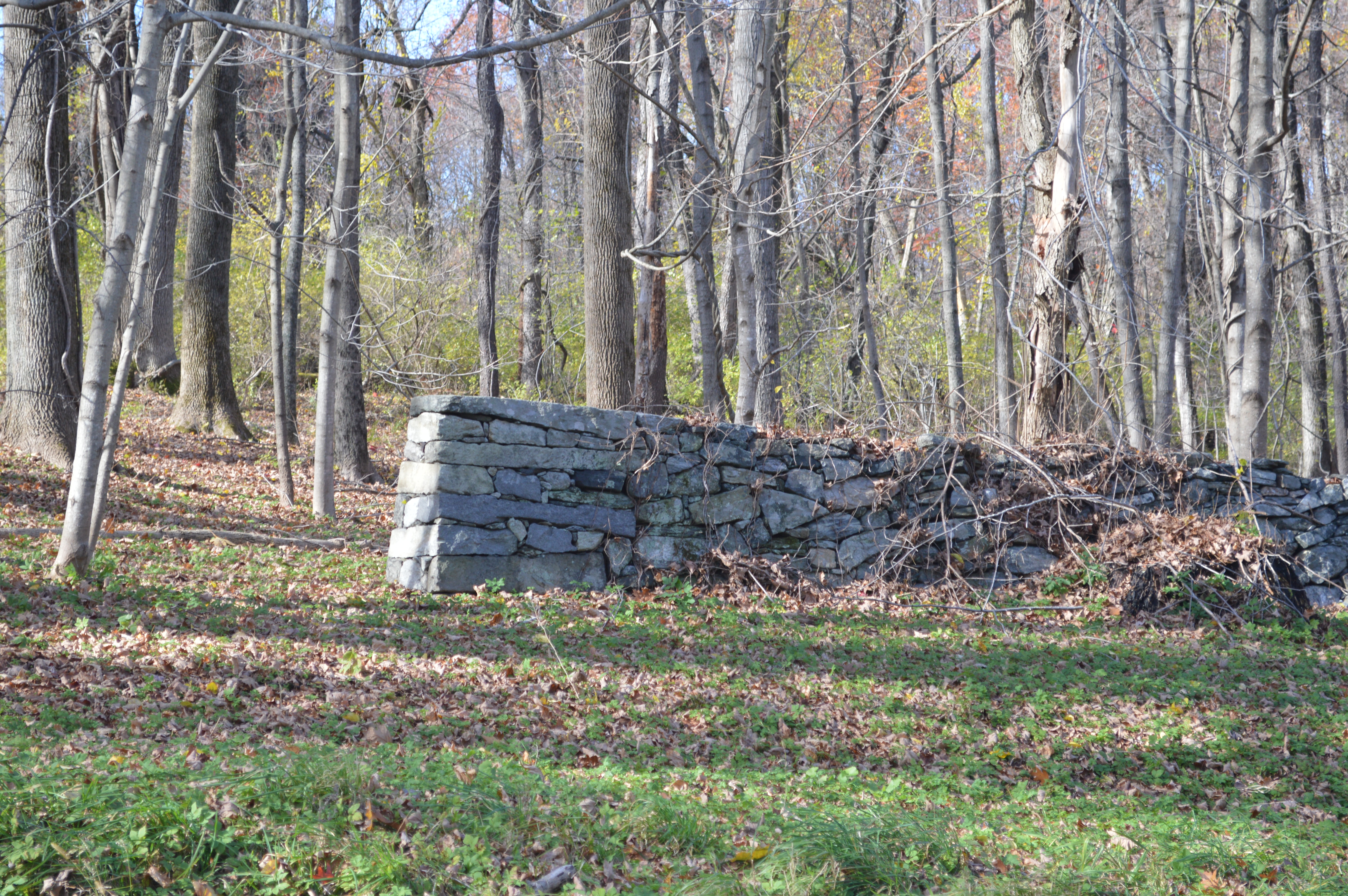
Laid Wall – Featured stones in a “weave” pattern.

DSC_1019

A 1939 study estimated that there were 240,000 miles of stone walls in New England, which contained more stone than the remaining monuments of the ancient world put together. Unfortunately, Connecticut (unlike Massachusetts and New Hampshire) has no law that protects its stone walls, and they are slowly falling victim to bulldozers or being quarried for new stonework.

Hidden in Plain Sight: The Book!

Please forgive a shameless self promotion …

Hidden History of Litchfield County, my book based on this blog, will be published by the History Press on November 4th.

You can learn more about it here.

Books are available for pre-order through The History Press or Amazon.

I will be doing book talks at the following locations:

Salisbury Association, November 15th, 4pm

Cornwall Library, November 22nd, 4pm

Litchfield Historical Society, December 7th, 1pm

None of this would have been possible without the readers who have supported this blog.  Thank you all very much!

Hidden Nearby: Housatonic Valley Regional High School’s 75th Anniversary

Housatonic_Valley_Regional_High_School_025

Prior to 1939, the six towns that currently comprise Regional School District #1 – Canaan, Cornwall, Kent, North Canaan, Salisbury, and Sharon – each had their own high school.  The cost of providing secondary education in such small towns, especially in the midst of the Great Depression, was becoming increasingly problematic.  In 1935, to reduce these costs and to provide a broader array of academic and extracurricular activities, William Teague (the state-appointed supervisor of rural education) proposed a consolidated high school for the six towns.  In 1937, the state legislature passed a bill creating the new district and establishing the first regional high school in New England.

Cornerstone

Later that year the Regional School Board purchased 75 acres of the Lorch farm at a central point in the region, overlooking the Housatonic River in Falls Village.  Ernest Sibley was hired as the architect and he designed the school in the Georgian Revival style that was popular among New Deal buildings. In 1938 the cornerstone of the building was laid.

construction

The land, building and equipment associated with the school cost $347,180.  Of this amount, $326,946 came from the Public Works Administration, a New Deal agency designed to build governmental buildings and structures.  Thus, Housatonic became one of the 7,488 schools built by the PWA.

paper

Paul W. Stoddard, an English teacher from Hartford’s Bulkeley High School, was hired as the school’s first principal and oversaw not only the hiring of the entire staff but also the drafting of the school’s curriculum.  When school opened for the first day on September 25, 1939, the school was in an unfinished state.  Its 374 students trod on bare cement floors, had no lockers, and heard no bells.

motto

A motto was selected for the school – Felix Prole Virum – “blest in offspring, wise and strong.”  As the towns of northwest Connecticut celebrate their high school’s 75th anniversary, that motto remains painted above the doors to the school.

East Cemetery’s Van Winkle Gateway

cem5

An outstanding job of brush clearing along Rt. 202 between Litchfield and Torrington has recovered the Van Winkle Gate of the East Cemetery.


cem3

East Cemetery, Litchfield’s largest, is, according to Alain White’s history of the town, the third oldest cemetery in town.  White identifies West Cemetery, established in 1723 as the oldest but does not state what is second.  In 1754 a committee consisting of Samuel Culver, Joshua Garritt, and Edward Phelps was formed to lay out a new cemetery closer to town.  Their work was finished in January 1755.  As is evident from the plaque above (which adorns the right side of the gateway), Edgar Van Winkle, Sr. served as president for the Litchfield Cemetery Association for 27 years.  Van Winkle was a Union College educated civil engineer and Union Army veteran who rose to be chief engineer of New York’s Department of Public Works.  He also worked for the Shepaug Railroad. 

cem4

On the left side of the gate are biblical quotations.  The first is: “Then shall the Dust return to the Earth as it was and the Spirit to God who gave it” from Ecclesiastes.  The second is: “Blessed are the Dead which die in the LORD that they may rest from their labors & their works do follow them” from Revelation.

stonewall

Originally the area of the cemetery behind the gate was designated for use as a highway, but when the cemetery expanded in 1837, the town voted to give the highway land to the Litchfield Cemetery Association that still maintains the grounds.  The stonewalls alongside the Route 118 frontage of the cemetery were built by public subscription in 1850.  The southeast corner of the cemetery – along this road – contains unmarked graves of Revolutionary War soldiers.

van winkle

The entrance to the cemetery on Route 118 is dedicated to the memory of Edgar Van Winkle, Jr., who also served as president of the Litchfield Cemetery Association.  

Monuments to the Great War

2013-11-29 14.59.06

This summer marks the 100th anniversary of the beginning of World War I. The global conflagration, which resulted in nearly 20 million deaths, had an impact on the small towns of Litchfield County. The above photograph shows two red oaks in front of the Bridgewater town hall. They were planted in 1922 in memory of two town residents who lost their lives in the war, Joseph Wellwood and John Sheskey.

 2013-11-29 14.58.50

Wellwood, 21 years old, enlisted in May 1917 and was assigned to an ambulance company. Sent to Kansas for training, he died there of scarlet fever in February 1918. Shesky was killed during an artillery barrage at the Battle of Vesle on September 3, 1918, a bit more than two months before the end of the war.

 litchmon

Many of the towns in the county have monuments commemorating their dead from the Great War, or the World War; those who put up these monuments in the 1920s and 20s had no inkling that another world war was approaching. Typical of these monuments is the monument on the Litchfield green. Stars denote those who died in the war.

 dono

However, a close examination of the Litchfield monument reveals that these stars were perhaps added to the monument later, with holes being drilled into the bronze and the stars inserted like a pin. Clayton Devines died of influenza (which killed 50 to 100 million people worldwide between 1918 and 1920) at training camp in Jacksonville, Florida. Joseph Donohue served in Company D of the 102nd Infantry. Killed in France, he had lived at the Junior Republic in Litchfield. His adopted hometown honored him by placing his name on the town monument and recognizing his sacrifice with a star still visible today.

 cattey

Henry Cattey was from Northfield, living on Marsh Road. He was also killed in action in France. While his name is on the memorial, next to it is only a small hole. Was there once a star that perhaps fell out over time? Cattey is not the only casualty of the Great War to have lost his star. Three names have stars next to them; six others have only the hole. It is fitting during this centennial that these stars be replaced and the proper tribute paid to these made who made the ultimate sacrifice for their country.

Hidden Nearby: John Sedgwick’s Grave and Monumenthttp://youtu.be/PVDBNIzGi6ghttp://youtu.be/PVDBNIzGi6gPVDBNIzGi6ghttp://youtu.be/PVDBNIzGi6g

P1160343

Author’s note:  See a related video about Litchfield and the Civil War done in cooperation with litchfield.bz here:   http://youtu.be/PVDBNlzGi6g

Along Route 43 in Cornwall Hollow lies the grave of one of the highest-ranking Union generals killed 150 years ago in the Civil War, Major General John Sedgwick.

The battles of the Mexican War in which John Sedgwick participated, from the monument in Cornwall Hollow.

The battles of the Mexican War in which John Sedgwick participated, from the monument in Cornwall Hollow.

Sedgwick was born in Cornwall Hollow on September 13, 1813. From a military family, he enrolled at the United States Military Academy after attending Sharon’s one-room schoolhouse. Graduating from West Point in 1837 he fought in the Seminole War and the Mexican War. While serving on the Kansas plains in the 1850s he received word that his family’s Cornwall Hollow home had been destroyed in a fire. He took leave from the army to build the house that still stands near his grave.

Major General John Sedgwick

Major General John Sedgwick

Sedgwick’s star rose rapidly after the firing on Fort Sumter. He was commissioned a brigadier general, then was promoted to command a division and ultimately the Sixth Corps of the Army of the Potomac. He was beloved by his men, who called him “Uncle John.” One of his soldiers described him as “an old bachelor with oddities, an addiction to practical jokes and endless games of solitaire.” He fought at some of the war’s most famous battles: Antietam (where he was wounded three times), Chancellorsville, Gettysburg.

"The Death of General Sedgwick, Spotsylvania, May 9, 1864" by Julian Scott.

“The Death of General Sedgwick, Spotsylvania, May 9, 1864” by Julian Scott.

Commanding his corps at Spotsylvania Court House on May 9, 1864, Sedgwick was surprised to see his men dodging the fire of a distant sharpshooter. “What, what!” he proclaimed. “Men dodging this way for a single bullet? What will you do when they open fire along the whole line. I am ashamed of you.” Laughing, Sedgwick announced, “They couldn’t hit an elephant at this distance.” Almost instantly a bullet struck “Uncle John” just under the left eye. His lifeless body fell into the arms of his chief of staff.

photo (7)

Sedgwick’s body was taken to Washington, DC, where a military procession was held. Another procession was held in New York City. More than 2,000 people turned out for the Cornwall Hollow funeral. In 1892, the Grand Army of the Republic marked the grave with an obelisk bearing the Greek Cross, symbol of Sedgwick’s beloved Sixth Corps. In 1900, Mr. and Mrs. Carl Stoeckel, friends of the general’s sister, erected the monument across the street, which bears the names of the Mexican and Civil War battles in which the general fought, and the inscription “the fittest place where man can die is where man fights for man.”

Hidden Nearby: Woodbury’s “Benjamin Franklin Mile Stone”

BF1

Some legends become carved in stone, or, in the case of Woodbury’s milestone, cast in iron.  The small plaque accompanying a milestone along Main Street in Woodbury states, “Benjamin Franklin Mile Stone.” The milestone itself reads “XIV M,” or fourteen miles. While there is a long-standing tradition that Franklin had these markers laid out – sometimes the legend even states that Franklin himself was involved in the placement of the stones – he was almost certainly not involved.

benjamin-franklin-520

Certain facts about the legend are true. Franklin did serve as one of two deputy postmasters general for the British colonies from 1753 to 1774. Franklin did oversee the modernization of postal roads during his tenure. And, the cost postage in that era was calculated by distance. However, there is no evidence in Franklin’s papers to corroborate the story, and while Franklin did serve as deputy postmaster general for 21 years, he was actually in the American colonies for only 6 years. The rest of the time he was in England on business representing the Pennsylvania colony.

Boston_Post_Road_map

Colonial post roads.

 A specific aspect of the legend claims that Franklin erected a series of milestones between Woodbury and Litchfield while on a trip to New England from June to November 1763. However, Franklin not only didn’t set foot in Connecticut on that trip, but neither Woodbury nor Litchfield had a post office at the time.

 BF2

Milestones had little to do with postal operations, being mostly “embellishments” set up in towns to aid passersby. Post riders were quite familiar with their routes, well aware of the mileages between different points. Still, there are mysteries surrounding the milestones. If it wasn’t Franklin, who did put them up? The series of milestones seems to be the work of different people, done at different times. And what does the distance relate to? Along modern Route 6, it is thirteen miles from Woodbury to both Thomaston and Newtown. Perhaps further study will reveal who constructed the milestone, and for what destination.

July 1989 Tornado

2013-11-29 11.55.40

This bell and plaque commemorate the United Methodist Church of Bantam, destroyed 25 years ago today by a tornado.

2013-11-29 11.55.21

On Monday, July 10th, 1989, a powerful family of tornados came out of New York State and ripped apart Cornwall’s Mohawk Ski Area, damaging every ski lift and carrying some of their chairs miles away.

Workers cleaning up the Cathedral Pines area after the tornado.  ctvisit.com

Workers cleaning up the Cathedral Pines area after the tornado. ctvisit.com

Atop any list of Litchfield County’s ecological treasures would have been Cornwall’s Cathedral Pines, at42-acres one of the largest stands of white pines and hemlocks (some reaching 120 feet high) east of the Mississippi. In one of the county’s first acts of ecological awareness, the Calhoun family purchased the land in 1883 to protect it from logging. The family donated Cathedral Pines to the Nature Conservancy in 1967. The tornado destroyed ninety percent of the trees in Cathedral Pines.

An early view of the Methodist Church in Bantam, destroyed by the tornado.  Bantam Historical Society.

An early view of the Methodist Church in Bantam, destroyed by the tornado. Bantam Historical Society.

Winds in excess of 150 miles per hour blew through Milton and Bantam, destroying homes, churches and stores.

Another tornado hit Watertown, and 12-year-old Jennifer Bike was killed when a tree fell on her tent in Black Rock State Park in Thomaston.

2013-11-29 11.53.35

2013-11-29 11.55.09

Today, a small park at the site of the Methodist Church – built in 1901 – in Bantam commemorates tornado. Within the foundation of the church are benches are gardens, a far cry from the fury unleashed on Litchfield County 25 years ago.

I was sixteen years old, working at Lake Waramaug Country Club in New Preston that afternoon. I vividly remember the sky turning a greenish color and a vicious thunderstorm rolling through. Please use the comments area on this blog to share your memories of the tornado.

Sandy Beach Memorial

2013-08-06 15.06.02

An earlier post examined the memorial to Alain and May White that stands near the Plunge Pool.  That monument, an inscribed boulder in the woods, was erected in 1980.  An earlier monument to these great conservationists stands at the entrance to Sandy Beach.

2013-08-06 15.06.24

In 1953, the White Memorial Foundation dedicated this monument.  It was designed by James Kip Finch, who served on the Foundation’s board of trustees from 1925 to 1966.

Sandy Beach, c. 1930.  (Courtesy Litchfield Historical Society)

Sandy Beach, c. 1930. (Courtesy Litchfield Historical Society)


Sandy Beach is an appropriate place for such a memorial, as one of the goals of the Whites was to make Bantam Lake’s shoreline available to local residents.  The Whites purchased the land in the 1920s from the Wadhams family, who farmed the area.  By 1929 Sandy Beach sported 30 bathhouses as well as a concession stand and a float in the lake.  Sandy Beach was widely popular from its inception.  It hosted nearly 650 visitors on a single day in 1929, and 30,000 people utilized the beach in 1930.  The beach offered cheap entertainment to a region facing the Great Depression.

Photo courtesy of litchfield.bz

Photo courtesy of litchfield.bz

The Whites established the Sandy Beach commission in 1928, which worked with the  Foundation to manage the site.  In 1976 stewardship of the beach passed to the towns of Litchfield and Morris.  After more than 80 years, however, Sandy Beach continues to serve its original purposes of offering local residents a refuge from the summer heat.

The Sign-Post Elm

DSC_0548

This is among the most hidden in plain sight of Litchfield markers.

DSC_0547

Today, Litchfield residents who wish to spread news of an event hang flyers at Stop and Shop, the Oliver Wolcott Library, or the Post Office, or information posted on Litchfield.bz. In an earlier day, Litchfield’s residents hung notices on the Sign-Post Elm.


The Whipping Post Elm (White, The History of the Town of Litchfield)

The Whipping Post Elm (White, The History of the Town of Litchfield)

Litchfield had many distinguished elm trees. Brothers Oliver Wolcott Jr. and Frederick Wolcott planted many elms along North and South Streets. John C. Calhoun planted elms at the corner of West Street and Spencer Street and also on Prospect Street when he was a student at the Litchfield Law School. The ominously-named Whipping Post Elm stood in front of the jail at the corner of West and North Streets.; at 150 inches he reportedly had the greatest diameter of any elm in town. Second was the Beecher Elm at 146 ½ inches, at the site of the family home on the corner of North and Prospect Streets.

The Sign Post Elm, with notices visible, at left.  (White, The History of Litchfield)

The Sign Post Elm, with notices visible, at left. (White, The History of Litchfield)


The Sign-Post Elm was not as big, but was, perhaps, of greater importance. For many years it stood at the corner of South and East Streets, in front of what is now the Litchfield Historical Society. It displayed the legal notices of the town, informed residents of town meetings, and hosted, under its branches, auctions and sheriff sales.

DSC_0550

The marker for the sign-post elm is visible as the small stone-like object to the left of the telephone pole in this photograph.

Henry_Ward_Beecher_-_Brady-Handy

Henry Ward Beecher

While Dutch Elm Disease, which was first discovered in the 1920s, has devastated the mature elm trees of North America, the value which Americans of an earlier ascribed to the elm is indisputable. Litchfield native Henry Ward Beecher, in an 1856 account about returning to his hometown, wrote: “There were the old trees, but looking not so large as to our young eyes. The stately road had, however, been bereaved of the buttonball trees, which had been crippled by disease. But the old elms retained a habit particular to Litchfield. There seemed to be a current of wind which at times passes high up in the air over the town, and which moves the tops of the trees, while on the ground there is no movement of wind period. How vividly did that sound from above bring back early days, when for hours we lay upon the windless grass and watched the top leaves flutter and marked how still were the under leaves of the same tree!”