LHRR Series: The Fourth Mile, into White Memorial


gates

The  gates to Whitehall, the estate of Alain and May White. The four mile mark of the Litchfield Hills Road Race is just beyond these gates.

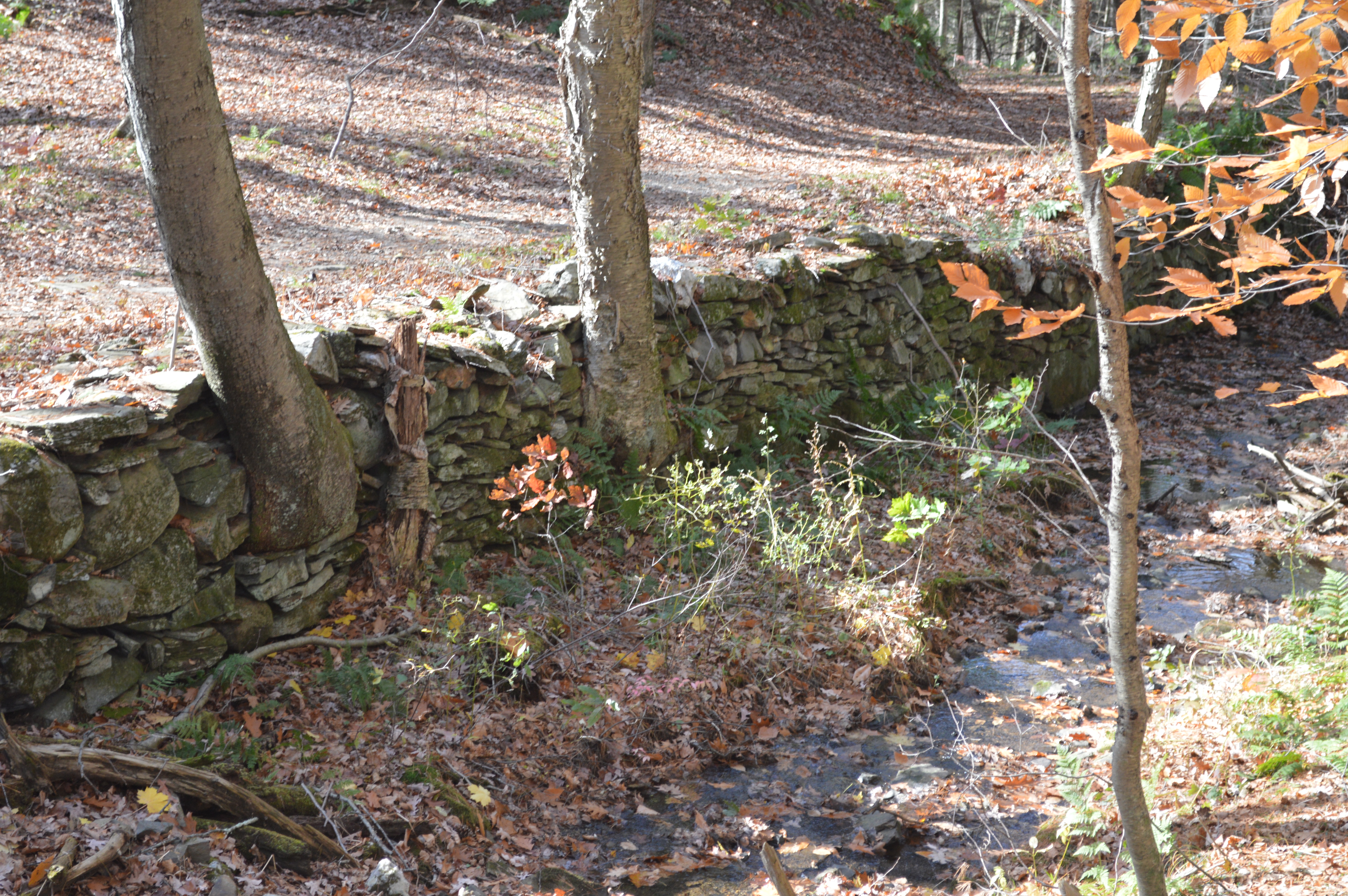
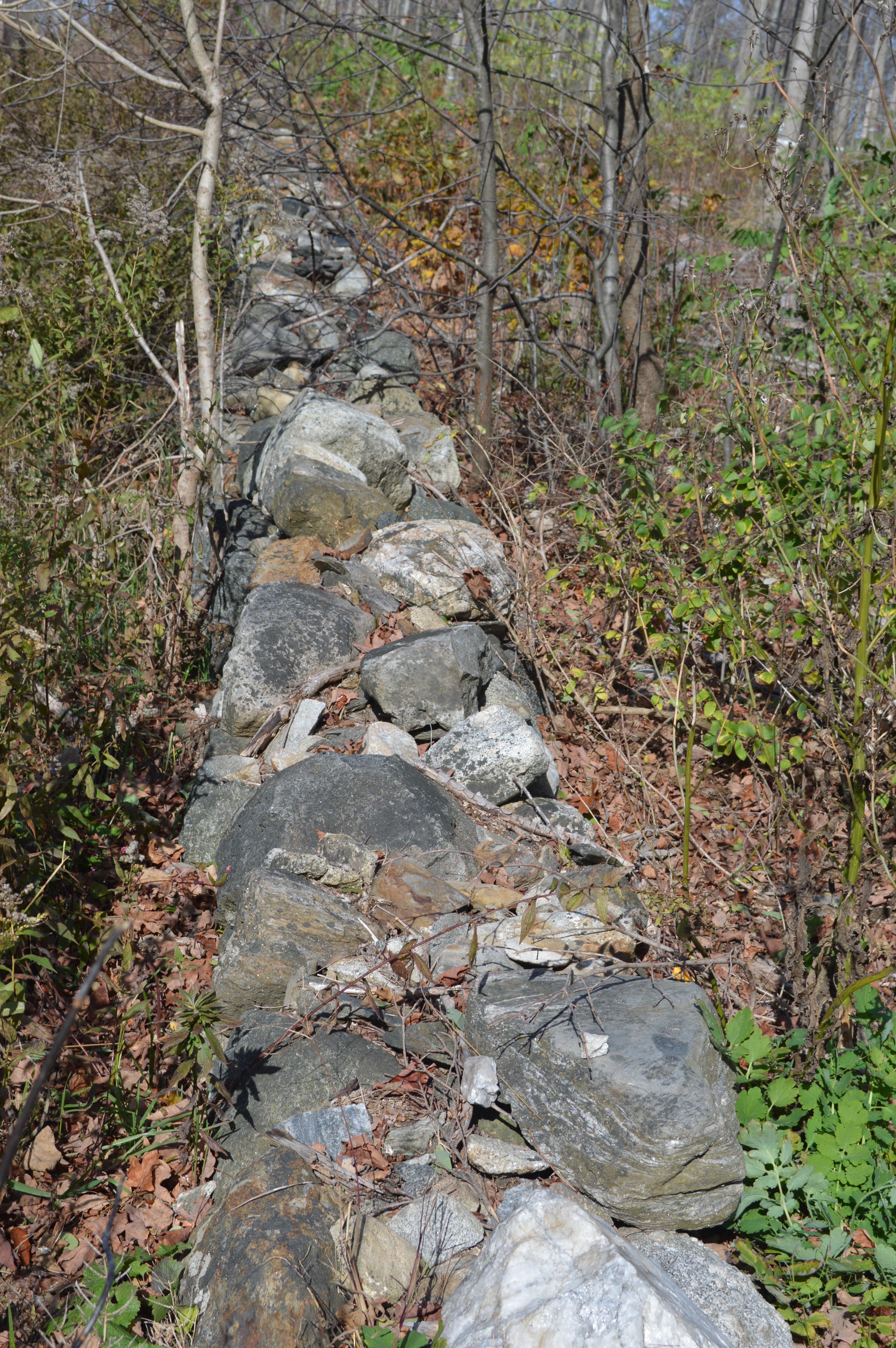
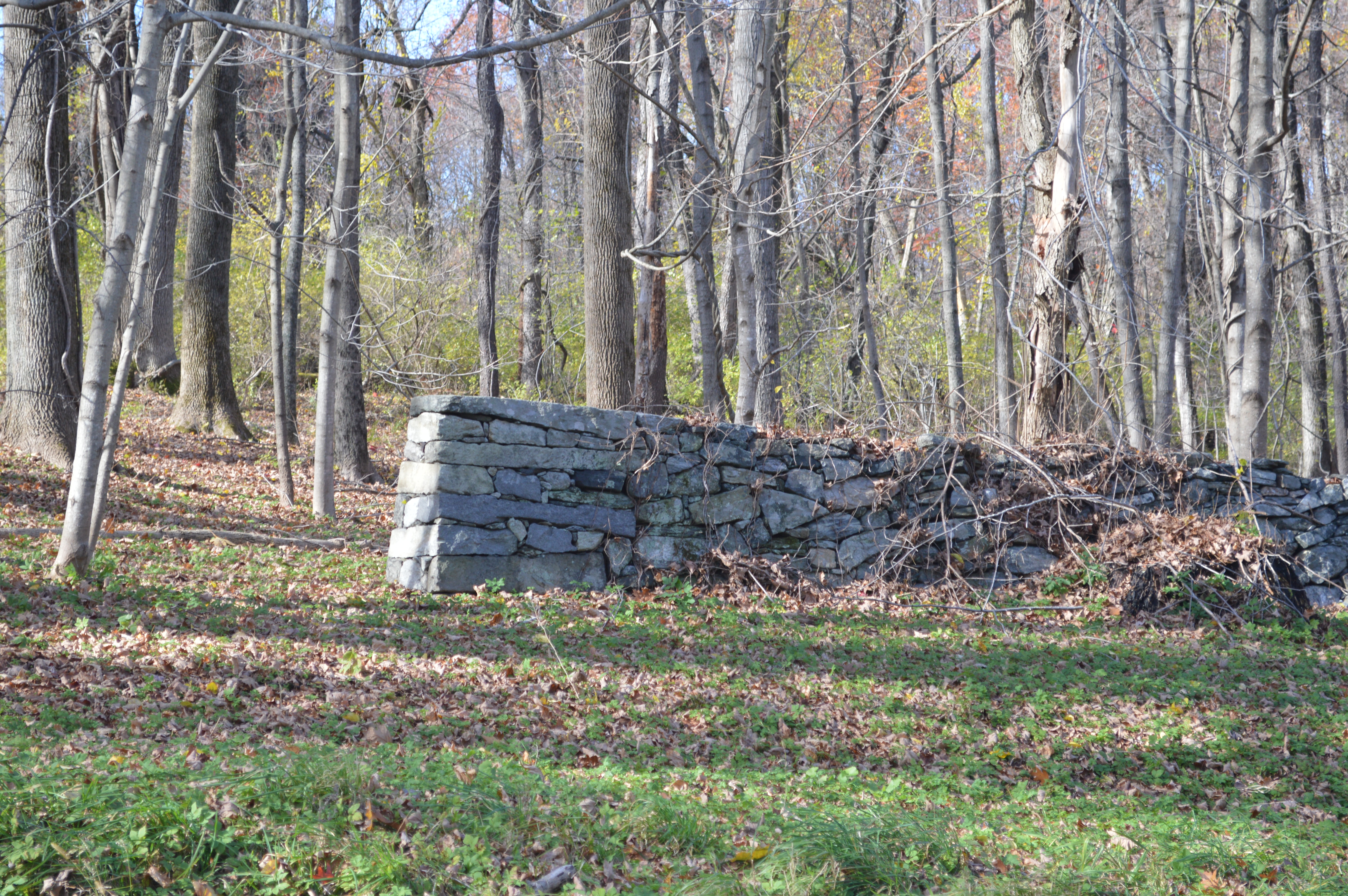
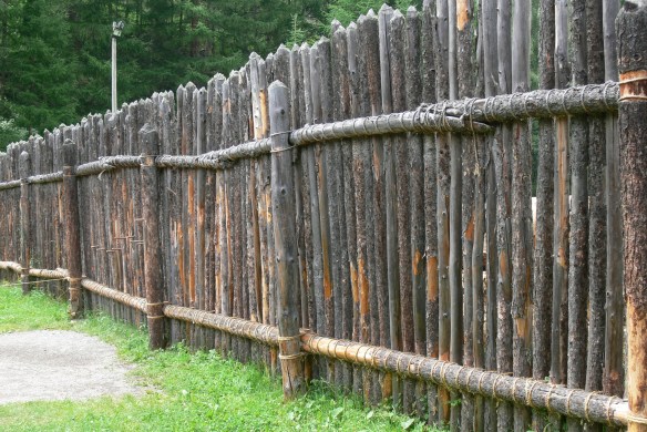
Passing the third mile marker, runners enter into the forests of the White Memorial Foundation. This was the brainchild of Alain and May White, siblings and children of John Jay White, a New York real estate tycoon who relocated his family to Litchfield following the New York City Draft Riots in the Civil War. The next post in this series will focus on the Whites and their home. As runners enjoy the solitude of the woods along Bissell and Whitehall Roads, let’s focus on their philanthropic endeavors.

An early 20th century view of a scene across from the current White Memorial Visitor Center.

Together Alain and May preserved nearly 9,000 acres of land that today comprise the White Memorial Foundation, Mohawk State Forest and Mohawk Mountain State Park, Kent Falls State Park, Macedonia Brook State Park, the People’s State Forest, Campbell Falls State Park, and portions of the Steep Rock Preserve.

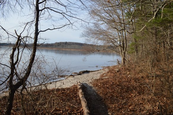
White family holdings along Bantam Lake


It began simply when Alain was fishing in the Bantam River with his friend William Mitchell Van Winkle in 1908. White commented, “Wouldn’t it be wonderful to preserve this river, lake and countryside as we see it now?” With May, he would devote nearly the next half century to acquiring additional lands for a preserve dedicated to the memory of their parents. The Whites’ goal was not simply to allow nature to run its course on these lands. Rather, as historian Rachel Carley notes, they hoped to “make shoreline available for youth camps, simple vacation home and convalescent retreats” This, then, was practical conservationism.

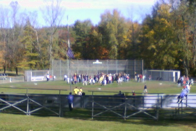
A LHRR runner in the White Memorial section of the race. (Courtesy scottlivingston.wordpress.com)

Runners rightly best remember them today for their remarkable contribution of a 4,000-acre backyard for Litchfield, a refuge not only for runners and animals but for hikers, bikers, birders, and kayakers.

For more information on the history of the Litchfield Road Race, see Lou Pellegrino’s forthcoming book A History of the Litchfield Hills Road Race: In Smallness there is Beauty. (Available May 2016)

Advertisement

LHRR Series: The Third Mile, Modern Architecture

John Johansen, 1916-2012

For many, the thought of a road race through Litchfield conjures images of colonial homes, painted white with black shutters. While the center of the town is dominated by colonial – and colonial revival – architecture, runners entering the third mile of the Litchfield Hills Road Race course become aware that the town also has important examples of modern architecture.

Litchfield Intermediate School (the orange and yellow sections are later additions)

To the left just as runners pass the two-mile mark to enter the race’s third mile is the Litchfield Intermediate School, designed as a junior high school in 1965 by John Johansen. Johansen – who along with Marcel Breuer, Landis Gores, Philip Johnson and Eliot Noyes was one of the “Harvard Five,” students of the noted Walter Gropius – had earlier designed the Huvelle House on Litchfield’s Beecher Lane. Noted for his individualist style, Johansen built the school into the side of Plumb Hill, and designed it with four main sections, an administrative heart along with a gym, auditorium, and classrooms. The school is particularly notable for its courtyards.

Litchfield High School, designed by Walter Gropius in 1954-56. 

Over the right shoulder of runners entering the third mile is Litchfield High School, designed a decade earlier by Marcel Breuer (another of the Harvard Five), and containing a striking gymnasium inspired by Walter Gropius, Johansen’s teacher and father-in-law and one-time director of the Bauhaus school. Additions have obstructed the dramatic side view of the gym as originally designed, but the wall of glass remains striking.

Marcel Breuer’s Gagarin I, built on Gallows Lane between 1956 and 1957.

Eliot Noyes’s addition to the Oliver Wolcott Library.

While runners grappling with Gallows Lane and the race’s final mile aren’t necessarily looking for modern architecture, two outstanding examples await. Breuer’s Gagarin I and II, while scarcely visible from the road, offer sweeping vistas to the west.  Eliot Noyes, yet another member of the Harvard Five, offered a modern addition to the Oliver Wolcott Library that complements the original 1799 structure.

For more on Litchfield’s architectural history, see Rachel Carley’s outstanding book, Litchfield: The Making of a New England Town.

For more information on the history of the Litchfield Road Race, see Lou Pellegrino’s forthcoming book A History of the Litchfield Hills Road Race: In Smallness there is Beauty. (Available May 2016)

LHRR Series: The Second Mile, The Shepaug Valley Railway

As runners pass the first mile mark, they begin to leave the town of Litchfield behind and enter the bucolic landscapes of ponds and forests that are characteristic of the race. It is easy to be lulled into thinking that the landscape always appeared this way. This mindset, however, will cause the runner to miss a significant piece of the town’s history.

IMG_3359 (2)

The entrance to the Litchfield Greenway on South Lake Street, once the route of the Shepaug Valley Railroad.

Reaching the bottom of Gallows Hill, the runner briefly turns on to South Lake Street. Here, the Shepaug Valley Railroad (later the Shepaug, Litchfield and Northern Railroad) crossed the road as it neared the end of its line at the Litchfield Station on Russell Street. A little over a mile of the railway’s path is preserved as the Litchfield greenway.


Shepaug2 (2)

A receipt for stock in the Shepaug Valley Railroad purchased in 1870 by Captain George Colvocoresses of Litchfield. Courtesy of Litchfield Historical Society.

The construction of the railroad was both celebrated and feared by the residents of Litchfield. When Edwin McNeil surveyed the line in the 1860s, he was met with threats by armed farmers. Construction began in 1870, with one crew beginning work in Litchfield and another in the Hawleyville section of Newtown. By January 1872, regular rail service was running to Litchfield. What passengers most noted about the journey was how winding it was; in one stretch, 32 miles of track with between 150 and 200 curves were needed to cover what the crow could travel in 17 miles.

CNE_map_Maximum

On this map of Connecticut railroads, the Shepaug Valley is depicted as a thin line between Hawleyville and Litchfield, indicating its relative traffic compared to the Housatonic to the west of the Central New England to the North.

Still, the railroad did provide greater access to the outside world for Litchfield residents. A passenger train that left Litchfield at 6:25 a.m. reached Hawleyville at 8:00 a.m., where a connecting train reached New York City’s Grand Central Station at 10:33 a.m. The line also transported iron, granite, manufactured goods, and ice from the county’s ice houses. The line went bankrupt twice in its first fifteen years, merged with the New York, New Haven and Hartford in 1898 (all the state’s railroads were eventually part of this line, known as “the Consolidated”), and ceased operations in 1948.

1989-0073_ph1492

The Litchfield train station, on Russell Street. 

Runners will again encounter the remnants of the Shepaug Valley Railroad when they exit the Plumb Hill fields and turn right on to Whites Woods Road. Here the railroad crossed from one side of the road to the other. And when runners turn from Bissell Road on to Whitehall Road and enter the White Memorial Foundation, they will be very near the point where the SVR turned from running parallel to Route 202 and headed toward its termination at Russell Street.

For more information on the history of the Litchfield Road Race, see Lou Pellegrino’s forthcoming book A History of the Litchfield Hills Road Race: In Smallness there is Beauty. (Available May 2016)

LHRR Series: The First Mile, The Litchfield Artillery

This is the first post in a series looking at the mile-by-mile history that took place along the course of the 7.1 mile Litchfield Hills Road Race. The 40th running of the LHRR takes place on June 12th. Look for a new post each week leading up to race day.

30440673

Photo courtesy of panoramio.com

It is a race that begins, metaphorically and literally, with a bang.

While runners enjoy the quick start to the race provided by the downhill slope of West Street, it is the firing of a reproduction of an 1841 six-pound cannon by the First Litchfield Artillery that sends the 1,500 runners on their way.

While the First Litchfield Artillery registered itself with the Secretary of the State in 1964, they are the heirs to a long tradition of militia organizations in Litchfield. As late as 1851, all able-bodied men between the ages of 18 and 45 were required to serve in the militia.

Archeoparc_-_Palisade_1

A modern reconstruction of a palisade.

The militia played an essential role in the town’s earliest days. From 1720 to 1730, five palisades – fences or walls made from wooden stakes that formed a secure enclosure –  offered defense for the town. These were located north, south, and east of the town, with a fourth in South Farms, the area of Litchfield that is now the town of Morris. The fifth palisade was at the site of the current courthouse, which runners pass immediately after the cannon fires. Legend holds that the widow Mercy Allen, one of the earliest settlers of town and the grandmother of Ethan Allen, helped build one of the palisades and manned it during threats of attack from Native Americans. Regardless of the veracity of the accounts of Mercy’s participation, members of the militia manned the palisades while townspeople worked in the fields and attended Sunday church services.

The defenses weren’t always successful. In May of 1722, Jacob Griswold was working alone in a field one mile west of the current court house when two Native Americans tackled him and carried him off to what is now North Canaan. Griswold, however, managed to steal a rifle from his captors while they slept, and made his way back to Litchfield. A mile or so north of town, he fired off the weapon, which warned the defenders in the nearby palisade of his plight. They helped ensure his safe return to town.

wolcott_oliverjr

Oliver Wolcott, Jr. Courtesy of Litchfield Historical Society.

Fifty-five years later, the presence of the British army in Danbury set off another alarm in Litchfield. The town’s militia was called out and sent south to drive out the king’s troops. Among those who participated was Oliver Wolcott, Jr., who was home from Yale. (Runners pass his home in the seventh mile.) His mother, Laura, sent him off with a blanket, a knapsack full of food, and an admonition to “conduct like a good soldier.” The Litchfield men encountered the British in a skirmish in Wilton, and helped force them to retreat.

2013-07-04 12.15.20 (2)

The modern-day artillery company is comprised of veterans who are United States citizens. Additionally, members are expected to be knowledgeable about Connecticut history. They work to preserve the traditions of horse-drawn artillery, participate in Memorial Day, Independence Day, and Veterans Day observances, participate in ceremonies at the request of the governor or the Connecticut Historical Commission, and help the governor uphold the laws.

Despite these lofty objectives, the artillery company is probably best known for sending nearly 1,500 runners through the streets of Litchfield.

For more information on the history of the Litchfield Road Race, see Lou Pellegrino’s forthcoming book A History of the Litchfield Hills Road Race: In Smallness there is Beauty. (Available May 2016)


Land Conservation in Litchfield County

There were more trees in Connecticut in 2010 than there were at any time since 1850. This, of course, reflects different land use patterns that have emerged as the state’s economy has evolved. In Litchfield County this is also a result of the willingness of residents to conserve rather than develop their land.

Roxbury

The Orzech Family Preserve, 112 acres near Route 67 and the Shepaug River in Roxbury.

The celebrities and artists who have long been attracted to the area have also been prominent supporters of land conservation, and nearly every town in the county has a land trust.  Some of these trusts are extraordinarily active; the Weantinoge Heritage Land Trust, for example, has preserved over 4,000 acres of land, mostly in Litchfield County.  The results of this movement have been profound. Perhaps the best example comes from George Black’s book, The Trout Pool Paradox, in which he laments the Naugatuck River south of Torrington as a “chemical sewer,” while the Shepaug River is the “Platonic ideal of a trout stream.”

IMG_2920

This carving on a boulder in the White Memorial Foundation honors Alain and May White.

Alain and May White were among the most extraordinary conservationists in the county. In addition to their own 4,000 acre preserve (what is now the White Memorial Foundation), the siblings additionally donated nearly 6,000 acres to fourteen Connecticut state parks, mostly in Litchfield County.

marcicostas

The Macricostas Preserve of Steep Rock, along Route 202 in Washington.

A similar operation to the Whites was taking place in Washington, where noted architect Ehrick Kensett Rossiter made the Steep Rock Land Trust his most lasting legacy to the town.  Rossiter began with a 100-acre purchase in 1881 – what would become the heart of the preserve – and continued to add land to the trust he established. Additional donations from the Van Sinderen and Macricostas families have brought Steep Rock’s holdings to nearly 3,000 acres.


Daffodils

The Morosani Preserve in Northfield.

The examples of the Whites and Rossiter are matched in spirit if not in size by dozens of more conservationists who have helped to preserve the county’s landscape.  Among these are the Morosanis, whose Laurel Ridge Foundation is noted for its daffodils every spring, Edith Morton Chase, daughter of a brass magnate whose home became Topsmead State Forest, and S. Dillon and Mary Livingstone Ripley, whose Kilvarock estate became the Livingstone Ripley Waterfowl Conservancy.


West Cemetery: Joseph Harris Memorial

DSC_0298

Encounters – and violence – between the earliest settlers of Litchfield and Native Americans was not uncommon. In 1722, Jacob Griswold of the town was kidnapped by a tribe and brought to present-day Canaan. His daring escape became the stuff of legends. Joseph Harris, one of Litchfield’s original settlers, was not as lucky.

The following year, Harris, known as a “respectable inhabitant” was attacked by a group of Native Americans while tending to his fields. When Harris attempted to escape, he was shot dead and scalped. Residents searched the area when Harris did not return to town that afternoon, but darkness put an end to their efforts. The next morning his body was found, sitting on the ground, his head resting against a tree near what is now Litchfield Ford. The area became known as Harris Plains.

013 (2)

The Harris memorial in West Cemetery, when the inscription was legible. (From Litchfield and Morris Inscriptions, 1905)

Harris was the first of Litchfield’s original settler to die. His burial spot was long forgotten, but in 1830 a memorial was erected to Harris in the town’s West Cemetery. The memorial still stands, but its inscription has become too difficult to read. It says:

In Memory of Joseph Harris who was murdered by the Indians in the year 1721.* While plowing in his Field in the vicinity of the Alms House, he was shot by the Indians concealed in Ambush. He was found dead Sitting on the Ground, his Head and Body reclining against the Trunk of a Tree. To record the first Death among the original Settlers of this Town & to perpetuate the Memory of a worthy but unfortunate Citizen this Monument is erected 1830 by the voluntary Benefactions of individual Subscribers

* While both Alain White and Rachel Carley’s histories of Litchfield say that Harris was killed in 1723, the monument states 1721.

East Cemetery: Grave of Richard Wallace

wallace5
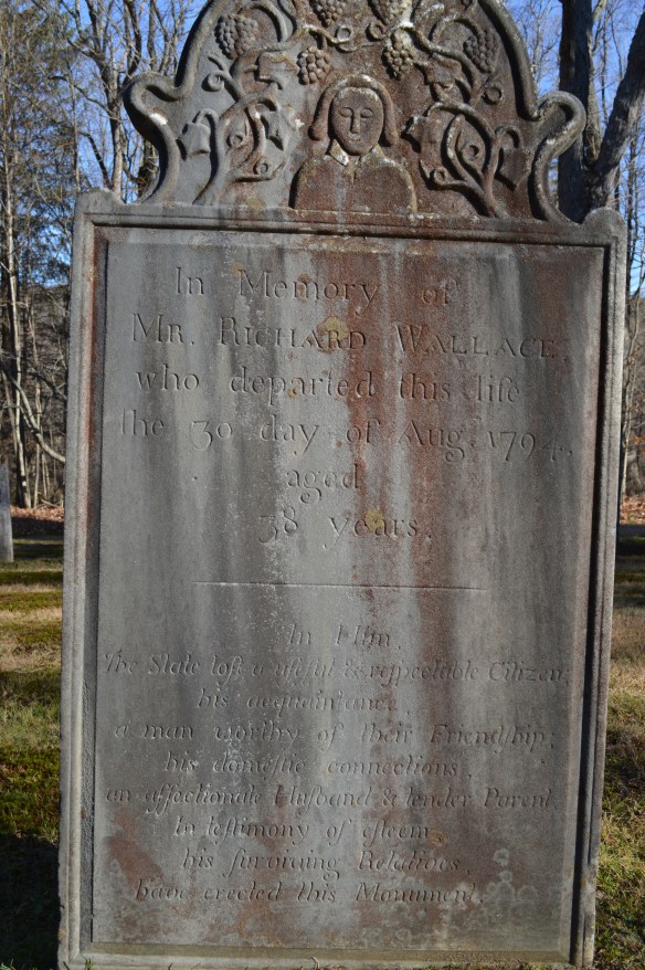
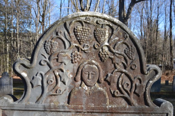
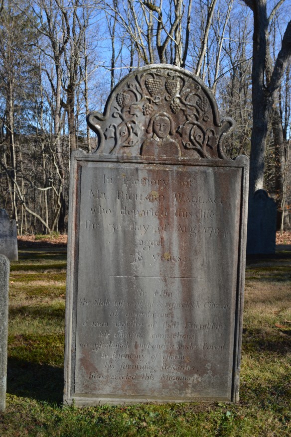
Richard Wallace of Litchfield died in 1794 at age 38. There are few extant records of his life in town; he participated in land tansactions, married, and had a family. In death, however, he was remembered with a striking gravestone in the East Cemetery.

wallace1

The text makes it clear how those close to him thought he should be remembered:

In him, the State lost a useful and respectable citizen, his acquaintance a man worthy of their friendship; his domestic connections, an affectionate husband and tender parent, in testimony of esteem, his surviving relatives have created this memorial.

wallace2

Equally interesting is the symbolism employed on the stone. A relatively generic rendering of Wallace, with closed eyes, is surrounded by grapes and vines. The grapes are representative of the Eucharistic wine. The vine is indicative of God’s relationship with man. As is written in the Gospel of John, “I am the vine, you are the branches. He that abideth in me, and I in him, the same bringeth forth much fruit for without me ye can do nothing.”


The Girl Scouts’ Camp Townshend


ctcabin

One of the remnants of Camp Townshend cabins

Beyond the White Memorial Foundation, Alain and May White contributed money and land to dozens of other ventures that have greatly impacted the Litchfield County landscape.   Among these are the Connecticut State Police barracks in Litchfield, Community Field, the land for Litchfield Intermediate and High Schools, Wamogo Regional High School, and the Bantam Civic Association.  They also donated 5,745 acres to 14 Connecticut state parks, most in northwestern Connecticut.

latrine

A latrine

The Foundation supported the Boy Scouts by leasing Camp Boyd, adjacent to Sandy Beach (the cabin burned in the 1970s) and the Girl Scouts through Camp Townshend, located along Alain White Road in Morris. Townshend opened in 1940, and by the end of that decade over 700 campers visited the property. The property could house 100 campers and 28 staff members for each two-week camp session, which began in late June.   In the late 1940s and early 1950s, Mrs. Barbara Cutler served as camp director, and the facility was overseen by a 22-member Budget, Planning, and Maintenance Committee.

cabin interior

The interior of a cabin. The writing on the wall says “Cloud, Lightning, Sun, Moon, Star, Rainbow, Rainbow, Bean Sprout, Corn, Blossom, Warrior Mark, Mark of Some Offices”

telephone

Remnants of old telephones?

While Camp Townshend closed in the mid-1970s, and was utlized by the Morris and Litchfield fire departments for  training exercises, a walk through the remains of Camp Townshend has the feel of visiting a Wild West ghost town. Even in the darkest days of fall and winter, it is easy to imagine the sounds of summer coming from the lake.

shore

The Camp Townshend shore line

Hidden Nearby: Local Baseball Legends

An early Litchfield baseball team. (Courtesy of the Litchfield Historical Society)

An early Litchfield baseball team. (Courtesy of the Litchfield Historical Society)

After Litchfield’s seemingly endless winter, the arrival of warm temperatures and of baseball’s opening day finally let us think spring has arrived. Fittingly, markers denote sites pertinent to the lives of two local baseball legends.

159975

Eddie Collins was born Millerton, NY, (just over the border from Litchfield County) in 1887, and graduated from Columbia University at a time when very few major leaguers were college graduates. (Lou Gehrig also attended Columbia). Two years before graduating, Collins had signed with Philadelphia Athletics so he played professionally as Eddie Sullivan to protect his amateur status at Columbia.  Collins went on to play 25 seasons in the Major Leagues, retiring at the age of 43. Over his career he won four World Series titles (3 with A’s, 1 with White Sox),  with a .333 average and 3314 hits. While a member of the infamous 1919 White Sox team that became known as the “Black Sox” for throwing the World Series, Collins was not suspected of being in on the fix, as he was believed to play have played honestly. Bill James, the noted baseball statistical analyst, ranks Collins as the greatest second baseman of all time.

The 1939 National Baseball Hall of Fame induction. Eddie Collins is seated at the left of the front row, next to Babe Ruth.

The 1939 National Baseball Hall of Fame induction. Eddie Collins is seated at the left of the front row, next to Babe Ruth.

Collins was voted into the National Baseball Hall of Fame in 1939 and took part in the first ever induction ceremony. (The first Hall of Fame class was 1936, but there were  no inductions until 1939.) As a participant in that ceremony, Collins stood on the steps of the Baseball Hall of Fame with such luminaries as Grover Cleveland Alexander, Ty Cobb, Walter Johnson, Nap Lajoie, Connie Mack, Babe Ruth, George Sisler, Tris Speaker, Honus Wagner and Cy Young.

BlassSteve

Steve Blass was born Canaan in 1942, and pitched at Housatonic Valley Regional High School (where according to legend he buried his baseball socks in the mound after his last game in 1960). In a ten-year Major League career with the Pittsburgh Pirates, Blass went 103-76 with a 3.63 ERA. In 1968, the famous “Year of the Pitcher”, Blass led the National League in winning percentage, going 18-6.  He won 19 games in 1972. The highlight of Blass’s career came with the 1971 World Series, when he won two games – including the decisive 7th game – allowing only 2 runs in 18 innings. Since 1983, Blass has been a TV and radio announcer for Pirates’ games. Canaan’s Steve Blass Field is named in his honor.

field

Steve Blass Field, North Canaan, CT

Stone Walls

DSC_1017

With the leaves off the trees fall is a great time to explore the stone walls of White Memorial. There is, perhaps, no better-known example of man’s reshaping of the Litchfield County landscape than stone walls. Robert Thorson, author of the superb history of these creations, Stone by Stone, wrote that “abandoned stone walls are the signatures of rural New England, the “relics of a vanished agricultural civilization.”

Perhaps there is no better metaphor for the history of Litchfield County than its ubiquitous stone walls. Constructed from colonial times through the middle of the nineteenth century, they stand as testimony to the intrepid early settlers who cleared the land in the hopes of making a living from the county’s soil. In plowing their fields, they utilized these unwanted stones to dam streams, mark roadways and property boundaries and pen in livestock. Yet the explorer is struck to find these vestiges of an earlier time in the county’s deepest forests, an indication that this land was once cleared and worked but has since been reclaimed by forests as lifeways in the county changed.

DSC_1015

The stones that form these walls were deposited by the Laurentide Ice Shield 15,000 to 30,000 years ago, which scraped down to New England’s bedrock and scattered billions of stones across the region. Initially, the earliest stonewalls were built from stones obtained from quarries. The “Little Ice Age” of the 18th century, however worked stones to the surface through deep freezes and the erosion caused by spring runoffs. Thus, the clearing of stones from pastures and fields became an annual spring ritual. Farmers brought these stones to the fences that lined their properties, often by hand or by sleds pulled by oxen. Over time, these piles were reworked into more architecturally-significant structures as the supply of labor on farms grew.  Eventually the walls shaped the landscape by forcing rain to different streams or building up soils.

DSC_1033

Stone walls served several purposes for farmers. When the communal land practices of the earliest colonial days shifted to a philosophy of individually owned land, stone walls were used to define boundaries. Farmers often piled stones until they reached the lowest level of a split rail fence.  Stone pens were utilized for what Thorson has termed the “strategic dropping of manure” for use as fertilizer. Elaborate stone walls were utilized as status symbols. More than anything, however, stone walls were simply ways to dump stones that were obstacles to farmers in their fields.

New England farmers built five principal types of stone walls. These are:

DSC_1014

Dumped Wall – A simple line of piled stones.

DSC_1026

Tossed Wall – With stones stacked like firewood, this is the most common of       stone walls. It required a bit more attention that the dumped wall.

DSC_1023

 Single Wall – stones piled on top of each other. These were used to surround pastures.

DSC_1011

Double Wall – Parallel walls with smaller stones used to fill in between.

DSC_1028

Laid Wall – Featured stones in a “weave” pattern.

DSC_1019

A 1939 study estimated that there were 240,000 miles of stone walls in New England, which contained more stone than the remaining monuments of the ancient world put together. Unfortunately, Connecticut (unlike Massachusetts and New Hampshire) has no law that protects its stone walls, and they are slowly falling victim to bulldozers or being quarried for new stonework.