Hidden Nearby: Harwinton’s Catlin Trough

DSC_0285

The Harwinton water trough stands a memorial to the original setllers of this part of town, and to the development of the Burlington Road/Harmony Hill Road Historic District area.  Harwinton was originally Hartford and Windsor’s Town, a tribute to the original emigrants who settled it.

DSC_0284

Next to the trough is this granite marker; it was once a drinking fountain.

Among those original settlers was Major Abijah Catlin (1715-1778), who was given a land grant here in 1738.  While there is considerable debate about whether the Abijah ever moved to Harwinton, his family maintained homes and businesses in this area for five generations.  His son, Abijah Jr., operated a store and an inn at the crossroads of Route 4 and Harmony Hill Road.  Here, in 1780, Catlin served refreshments to George Washington, the Marquis de Lafayette, and General Henry Knox.  One of his descendants, George Catlin, was educated at the Litchfield Law School and served in the United States Congress.

DSC_0294

Photo courtesy of Harwinton Historical Society.

The Catlins placed a trough at this location at some point in the 18th century.  It utilized a nearby spring and gravity to provide horses and oxen passing by with a source of drinking water.  It operated until the early 20th century.

DSC_0296

Much like the Goshen animal pound, the trough reminds us of the integral role animals played in the lives of those who lived in this area two centuries ago.

The Center School Inscription

2013-08-06 12.02.13

This post is the second to be accompanied by a video hosted by litchfield.bz. You can access the video here: http://m.youtube.com/watch?v=Tql0h1SAqUE&desktop_uri=%2Fwatch%3Fv%3DTql0h1SAqUE

From the 18th through the early 20th century, public education in American towns was run through small school districts. These districts were organized around one-room schoolhouses and were situated to be within walking distance of homes. For example, when established in 1774 the school in Northfield constituted Litchfield’s 14th school district.

The school for the borough of Litchfield was located on West Street, but Arthur Bostwick who was born in Litchfield in 1860 and became a prominent librarian and author, wrote that “nobody went to it who could afford a term’s tuition at the Institute.” (This institute stood on North Street; the Wolcott Institute on South Street closed the year before Bostwick’s birth). This school was destroyed in the great fire that swept town in 1886.

Litchfield High School, on East Street.

Litchfield High School, on East Street.

Two years later a high school opened at the top of East Street. Students were required to study grammar, literature, arithmetic, United States History and geography.

2013-08-06 12.01.08

“1725 First Public School Appropriation”

2013-08-06 12.01.35

“The Center School Litchfield”

2013-08-06 12.01.42

“Bicentennial building dedicated 1925”

There was a movement In the early 20th century to combine the scattered school districts into “consolidated” or “center” schools. It was believed that this would offer students a more specialized education at enhanced economic efficiency to the town. The result for Litchfield was Center School, which opened its doors in 1925, the bicentennial of Litchfield’s first school. This anniversary was commemorated in the inscription at the top of the building. While the building has gone from housing all of Litchfield’s students to only those in grades K-3, the inscription remains as a reminder of the town’s educational history.

The Litchfield Garden Club

DSC_0024

This stone flower urn stands at the intersection of North Street and Norfolk Road in Litchfield.  There are no markers or inscriptions to tell the curious passerby when or why it was built, or by whom.  Further investigation, however, reveals that this is one of the many contributions made by the Litchfield Garden Club to beautify the town.

LGC-CentLogoFinal_jan2012_722013 marks the 100th anniversary of the Litchfield Garden Club.  On September 9, 1913, nine women from the Litchfield area met at the home of Edith and Alice Kingsbury on North Street and organized the club, with annual dues of two dollars.  S. Edson Gage, an architect who had designed the Litchfield Playhouse that stood at the  site of the current town hall, was elected president.

2013-06-29 08.36.45

The old Litchfield train station on Russell Street.

The organization’s first civic project took place in 1914, when – in cooperation with the Village Improvement Society – they spent ten dollars for plantings at the town’s train station on Russell Street.  After the First World War the club was active in maintaining the plantings at the train station as well as beautifying the grounds of the town’s schools and library, and in creating Litchfield’s Wild Gardens on land leased from White Memorial.

trough

Flowers planted by the Garden Club in the trough of Litchfield’s Water Monument.

The Norfolk Road planter was installed in 1954 (the club’s website indicates there may have been others along Norfolk Road), flowers were planted at traffic intersections, and the organization was also instrumental in getting Litchfield’s Historic District added to the National Registrar of Historic Places.  More recently, the club has replanted the trees along North and South Street that were originally planted by Oliver Wolcott, Jr. to commemorate the original 13 states and installed period lighting on the Litchfield Green.

Happy 100th anniversary to the Litchfield Garden Club, which has done so much to enhance the natural beauty of our town!

The Frances Howe Sutton Bridge

sutton bridge

The Frances Howe Sutton bridge on the Little Pond Trail in White Memorial Note the plaque on the right side of the bridge.

The most popular trail in the White Memorial Foundation is the boardwalk that encircles Little Pond.  The bridge in the photograph above, which carries a plaque honoring Frances Howe Sutton, spans the outlet of the pond, where the Bantam River turns toward Bantam Lake.

Wild Garden Map

A 1932 map showing the Litchfield Wild Garden. The Sutton Bridge appears at the bottom. “Map of the Litchfield Wild Garden” Litchfield Historical Society, Helga J. Ingraham Memorial Library. Thanks to Linda Hocking at the Litchfield Historical Society for providing the digital image.

In 1922, the White Memorial Foundation leased 150 acres east of Little Pond to the Litchfield Garden Club for the “creation and maintenance of a wild garden containing trees, shrubs and flowers native to Connecticut and to Litchfield County.”  (The Garden Club paid $1.00 to lease the land for ten years.)  The garden club created trails through this area to allow visitors to access the flora.  This became known as the Litchfield Wild Garden.  In 1928, the Munroe Bridge was built to offer visitors access to the west side of the Bantam River as it flowed into Little Pond.  (This is the bridge near the Litchfield Country Club.)

suttonTen years later, Herbert L. Sutton financed the construction of a second bridge, which was built in memory of his wife, Frances Howe Sutton.  This bridge crossed the river as it flowed out of Little Pond, and gave visitors access to the Pine Island section of White Memorial.

sutton 3In subsequent years management of the Wild Garden passed from the Litchfield Garden Club to the Wild Garden Association and then to the Litchfield Hills Audubon Society.  In 1959, the boardwalk was completed around the entirety of Little Pond, in memory of Ralph T. Wadhams.  Finally, in 1975, the area of the Wild Garden reverted back to White Memorial.  While the trails in this area are no longer maintained, the careful observer can still locate where they once ran.

little pond

The view from the bridge.

In September 1985, flooding from Hurrican Gloria necessitated a rebuilding of the boardwalk.  Ultimately this project required 57,000 board feet of lumber, 2,600 hours of labor, tons of nails, and $73,000 to repair the 1.2 mile trail.  While entire sections of the trail and uncounted individual boards have been replaced since 1985, the structure of the boardwalk remains today.  Those who have ventured to Little Pond for birding in the spring or to admire the stark beauty of a New England winter understand why this trail remains White Memorial’s most popular.

For more information on the Little Pond boardwalk, see Keith R. Cudworth, The White Memorial Foundation:  The First 100 Years, The Legacy of Alain and May White (White Memorial Foundation, 2012).

West Cemetery’s Civil War Effigy Graves

IMG_3402Memorial Day is an appropriate time to reflect on the staggering statistic that forty percent of all Union dead in the Civil War were unidentified.  While this was a marked improvement from the Mexican War fifteen years earlier – in which 100% of the American dead were buried in unmarked graves – it nonetheless posed a particular problem for Americans.

death-george-washington

The Death of George Washington – a classic representation of the idea of the “good death.”

Death held a central place in the culture of Victorian America.  Society dictated that there was such a thing as a “good death,” in which the deceased expired in his own home, surrounded by loved ones.  To such a religious society, the dying individual was closer to God, and therefore his final words were dutifully recorded as being of great importance.

TimeCivilWar_p139_Embalming_slideshow

A Civil War embalmer

The deaths of hundreds of thousands of Americans in the prime of their lives at great distances from their homes and families was therefore at variance with the notion of the “good death.”  While thousands of dollars were spent on embalming bodies to return them home for burial,  many families were left without even a place to mourn their fallen soldiers.

IMG_3403A solution was the effigy grave, a memorial stone for a victim whose body – because it was unidentifiable or for financial reasons – was unable to be returned home.  The Civil War graves grouped together in Litchfield’s West Cemetery (with a monument of a drum labeled “Mustered Out) are a good representation of these graves.

IMG_3405These men fought on some of the most famous battlefields of the Civil War.

IMG_3406Others suffered through unimaginable horrors in prisoner of war camps.

Perhaps these memorials gave some comfort to the families of these soldiers in the aftermath of the war.  One hundred and fifty years later, the stones continue to remind passersby of these soldiers’ service to our nation.

Hidden in Plain Sight: The Walking Tour!

OLYMPUS DIGITAL CAMERA

The Litchfield Historical Society is sponsoring a walking tour based on this blog on Saturday, May 18th, at 10:00 a.m.  We’ll explore some of the sites previously discussed on these pages and share thoughts about some that will appear in the future.  The tour will focus on sites on the Litchfield Green and nearby South Street.  Visit the historical society’s website – http://www.litchfieldhistoricalsociety.org – for more information and for registration.

Hope to see you on the tour!

Northfield’s Civil War Monument

northfield monumentIn the center of Northfield’s small triangular green sits the borough’s Civil War monument.  While notable for the beautiful flame finial at its top, what really makes this monument remarkable is the story of its origin.

names 2Looking to memorialize the men from Northfield who died during the war, a committee was chosen from a public meeting held at Northfield’s center schoolhouse on January 16, 1866.

names 3This was only nine months after Lee’s surrender at Appomattox, making this one of the oldest Civil War monuments in the country.

flame finialThe site was chosen because it the Episcopal church had recently moved.  Nelson Bolles of Marbledale executed a design for a brownstone obelisk, and a team of thirteen oxen driven by Northfield resident Joel Thorpe brought the monument to Northfield.  Julius Grover, a sculptor whose niece lived in Northfield, carved the remarkable flame finial, which perhaps serves as an eternal flame, reminding future generations of the sacrifices of Northfield’s men in the Civil War.

lincolnThe names of the dead are carved on three sides of the monument, and are joined by the name “LINCOLN”, whose assassination was still fresh in people’s minds.  Also carved on the monument are the words “That the generations to come might know them,” taken from Psalm 78.

names 1

The men listed on the Northfield monument are:
Morton Castle, died of wounds received at the Battle of Antietam
Charles Castle, died in a Virginia hospital
Horace Hubbard, killed at Winchester
Hiram Cooley, killed at Winchester
David Wooster, killed at Fisher’s Hill
Walter Hale, killed at Chancellorsville
Joseph Camp, killed at Cold Harbor
Henry Miner, died in a Virginia hospital
Apollos Morse, killed at Cold Harbor

flame finialWhile the committee hoped the monument would be in place by July 4th, 1866 (the nation’s 90th birthday), delays postponed the dedication until September.    Still, Northfield’s monument was dedicated eight years before Litchfield’s Civil War monument, and twenty years ahead of the nationwide movement to memorialize its Civil War dead.

(NOTE:  The Civil War monument in Berlin, Connecticut, erected in July 1863, is believed to be the oldest in the country.  See The Hartford Courant, March 24, 2013.)

Revolutionary War Soldiers’ Tree

Rev war Tree 2

This small marker stands at the southeast corner of the eastern section of the Litchfield Green.

The first Arbor Day was held on April 10, 1872 and became an international event eleven years later when Birdsley Northrup of Kent, Connecticut, introduced the event to Japan.  However, Theodore Roosevelt’s ascendency to the presidency in 1901 and his emphasis on conservation issues sparked a nationwide surge of interest in Arbor Day.

In 1902 the Mary Floyd Tallmadge Chapter of the Daughters of the American Revolution celebrated the first Arbor Day of Roosevelt’s presidency by planting a tree on the Litchfield Green to commemorate the services of the town’s Revolutionary War soldiers.

Revolutionary War Soldiers

In all, 507 men from Litchfield served the Patriot cause between 1775 and 1783.  The first to serve were the men of the company led by David Welch of Milton, who were called up soon after news of Lexington and Concord arrived.  A second company enlisted in January 1776 to serve for the defense of New York City.  They drafted a contract specifying the terms of their service under Major General Charles Lee, stating that they were convinced of “the Necessity of a body of Forces to defend against certain Wicked Purposes formed by the instruments of Ministerial Tyranny.”  They specified, however, that they would not serve for more than eight weeks, and stated that General Lee had “given his Word and Honor” to uphold these terms.

fort washington

The Battle of Fort Washington

In November 1776 another company of Litchfield men under Captain Bezaleel Beebe set off for New York.  Thirty-six handpicked men of the company under Captain Beebe were sent to reinforce the American garrison at Fort Washington (today the Manhattan end of the George Washington Bridge).  The men marched into a trap, and were forced to surrender with the entire 2,600 man garrison of the fort.  Although the men were exchanged about a month later, only 11 of these men made it home to Litchfield.

In March 1777 a new call for troops went out, and Litchfield was tasked with enlisting 92 of its men.  The town voted to pay 12 pounds per year to each soldier and to supply “necessaries” to each soldier’s family.  A final call for troops reached town in 1781, and a “selective draft” took place, in which the town was divided into three classes and each class was expected to raise a certain number of men.

Interior of the Old Jersey Prison Ship

Interior of a British prison ship

In addition to those men who were killed and wounded in battle, twenty Litchfield men died while on the dreaded British prison ships.

Rev War Tree

Today, a small stone marker stands at the foot of the tree dedicated to these soldiers.  Its faded inscription reads:

Planted in Memory of

Litchfield’s Revolutionary Soldiers

by the

Mary Floyd Tallmadge Chapter

DAR

Arbor Day 1902

Connecticut Highway Department Markers

Connecticut Highway Department marker near the Gooseboro drive-in in Bantam.

Connecticut Highway Department marker near the Gooseboro drive-in in Bantam.

There are among the most ubiquitous markers on our man-made landscape.  Usually between twelve and eighteen inches high, they are simple stone blocks engraved with the initials “CHD.”

A Connecticut Highway Department marker alongside Route 4 by the Torrington Country Club,

A Connecticut Highway Department marker alongside Route 4 by the Torrington Country Club,

“CHD” stands for the Connecticut Highway Department, a state agency that was incorporated into the Department of Transportation in 1969.  At one time, however, it was responsible for the construction and maintenance of all state roads.

CHD South Street 2

A Connecticut Highway Department marker abuts the sidewalk on the west side of South Street in Litchfield.

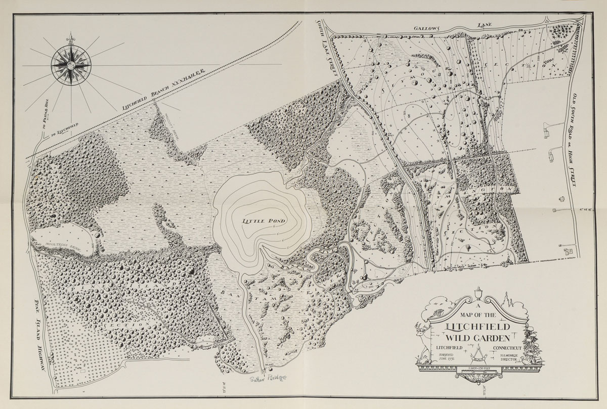
The Connecticut Highway Department began preparing highway boundary maps in 1926; much of the work was completed by the Works Progress Administartion during the Great Depression.  These maps were done in accordance with a statue passed in 1925 that required that the “Highway Commissioner … mark such boundary limits by a uniform and distinctive type of marker.”  The stone “CHD” markers satisfy this requirement.

CHD Litch Green 2

Three Connecticut Highway Markers denote the right of way to widen the turn along the northeast corner between the middle and eastern sections of the Litchfield Green. One marker is visible at the extreme right of the photo; a second is partially hidden by the tree at the front right; the third is visible between the telephone pole and tree in the background.

The highway department was originally created specifically to build highways.  By 1923, however, its tasks had expanded to eliminating dangerous conditions on roads, improving the roadsides, installing proper warning signs, removing snow and ice from the highways, and – pertinent to these markers – establishing boundary lines alongside the highways and securing the rights of way for the purpose of widening and straightening roads.

To oversee these last two tasks, the Connecticut Highway Department created the Bureau of Highway Boundaries and Rights of Way.  The bureau had three major tasks:  land titles, boundary surveys, and right of way purchases.  When it was determined that a new road needed to be built, the bureau conducted a title search, acquired the property and was charged with “properly marking the boundaries of all state roads” (Forty Years of Highway Development in Connecticut, 16).  The result of this, of course, are the thousands of stone markers that dot Connecticut roadsides.

The stone “CHD” markers have interesting stories to tell to those explorers willing to look into them.  The “CHD” marker above is on Prospect Street, a town road, not a state road,  However, a look at an old map shows that this was once the site of “Wolcott Road.”  While this road was subsequently closed, the right-of-way is still maintained by the state.

These stone markers are a thing of the past, however.  Today, the Connecticut Department of Transportation marks its property flush to the ground, with bronze discs engraved with “CTDOT.”

Hidden Nearby: Goshen’s Animal Pound

Pound1

The History of Litchfield County, published in 1881 by the J.W. Lewis Company in Philadelphia, suggests that North Goshen was once a thriving community.  The book offers a house-by-house guide of the area, describing the residents and their commercial and religious activities.

Pound sign

Today, nearly all vestiges of the community are gone, the land owned by the Torrington Water Company.  There are a few hints remaining, however, to the history of this area.  Along East Street North stands an animal pound, a sign suggesting that it was built “circa 1800.”

cattle

Animal pounds were a common sight in early America, as livestock often roamed free.  In fact, at the meetings that established the town of Goshen in 1739, the residents appointed three horse branders whose task was to apply a distinctive mark to each resident’s animals.  That year, 66 distinct marks were recorded in Goshen.

At that same meeting, two men were given permission to build town pounds.  Livestock, by town ordinance, could roam free from March to November.  However, those not in their owner’s barns by November would be impounded and cared for by the town’s pound keeper.  When the owner arrived at the pound to claim his animal, he would pay a fee to the keeper.  Town records in Goshen also indicate that those delinquent in paying their taxes could work off their debt by supervising the town pounds.

Pound 2

The walls of the pound had to be wide enough so that an animal couldn’t step over them.

As part of Goshen’s 250th anniversary in 1989, the Torrington Water Company restored this pound.  Its walls are 35 feet long and 25 feet wide, and stand 4 feet high.

Structures like the Goshen animal pound offer the 21st century explorer a glimpse of life nearly three centuries ago, and remind us of the centrality of livestock to the daily existence of those who inhabited Litchfield County.