Hidden Nearby: Tory’s Cave and the Other Side of the Fourth of July

Tory’s Cave in New Milford

The Fourth of July brings to mind a famous statement by John Adams, in writing to his wife Abigail about the adoption of the Declaration of Independence: “I am apt to believe that it will be celebrated, by succeeding Generations, as the great anniversary Festival. It ought to be commemorated, as the Day of Deliverance by solemn Acts of Devotion to God Almighty. It ought to be solemnized with Pomp and Parade, with Shews, Games, Sports, Guns, Bells, Bonfires and Illuminations from one End of this Continent to the other from this Time forward forever more.” (That Adams was talking about July 2nd is a fun fact, but not important to our story.)

Image result for john adams

John Adams

Another Adams observation is relevant as well. Adams is often quoted as saying that in the American Revolution, one-third of Americans were patriots, one-third were lukewarm to revolution, and one-third continued to support the king. This is a misquote; Adams was referring to hostilities that arose between Britain and France during his presidency. This does not, however, change the fact that substantial numbers of Americans were hostile to the cause of independence.

Image result for tar and feather

A Revolutionary-era propaganda print depicting a tar and feathering, in this case over opposition to the Tea Act.

One study has estimated that 6% of Connecticut’s population were Loyalists (also known as Tories). These were concentrated in the western part of the state. Litchfield County’s Tories continued to support the king largely for religious reasons; for example, St. Michael’s Church (now Episcopal but during the war part of the King’s Church of England) repeatedly had its windows broken out of contempt for its Loyalist members. Occasionally, hostile feelings toward Litchfield County’s Loyalists turned violent. Parts of Harwinton and Plymouth were hotbeds for Toryism, and one Plymouth Tory was “hung up till almost dead” on the town green. New Milford, which still contains the topographical feature called Tory’s Cave, witnessed the sentencing of a Loyalist to having to carry a goose to Litchfield for his own tar and feathering.

Image result for william franklin

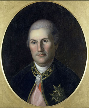
William Franklin, loyalist governor of New Jersey

The town of Litchfield, relatively safe from British incursions, was used to jail prominent Loyalists, including New Jersey governor William Franklin (son of the decidedly anti-Loyalist Benjamin) and David Matthews, mayor of New York City. Ultimately, most of Litchfield County’s Loyalists abandoned their property and fled to Canada. While our celebrations of the Fourth of July continue to make Adams’s prophecy about “bonfires and illuminations” come true, it is important to remember that American independence was neither guaranteed nor unanimously supported.

Hidden Nearby: North Canaan’s Monument to the Convention Army’s March

march1

The monument to the Convention Army’s march, “the Revolution’s longest” on Sand Road in North Canaan.

My last post featured the sign in Southbury commemorating the march of General Rochambeau’s French army across the southern border of the county during the Revolutionary War. A second Revolutionary War army had traveled across the northern edge of the county three years earlier. This march is commemorated by a marker along Sand Road in North Canaan.

Surrender of General Burgoyne by John Trumbull. The original hangs in the Rotunda of the United States Capitol.

Following the victories of the American army at Saratoga in September and October 1777, British General John Burgoyne surrendered his army of about 6,000 men on October 17th. The terms of the surrender – known as the Saratoga Convention – stated that these British soldiers were to be paroled upon a promise to never fight against the Americans again. As the terms required approval by King George III, the British prisoners were marched to Cambridge, Massachusetts, to get them away from the approaching Adirondack winter. They arrived there in early November, taking up quarters that had been built by the British in 1775. Many of these men were sent to work for local farmers during the day. Approximately 1,500 British escaped, as legend holds that they became romantically involved with the daughters of these farmers.

Related image

A Viginia historical marker commemorating the end of the Convention Army’s march in Charlottesville.

In November 1778, with the terms of the convention still unratified and with Burgoyne refusing to provide a list of names of his officers so that Americans could ensure they would not fight again, the terms of the convention were revoked. The remaining British soldiers departed Boston, bound for Charlottesville, Virginia. This was, as the monument in North Canaan testifies, the longest march of the Revolutionary War. Entering Connecticut at Suffield, the British (and German Hessian) prisoners and their American escorts passed through Litchfield County’s Barkhamsted, New Hartford, Winchester, Colebrook, Norfolk, North Canaan, Salisbury and Sharon. A separate column comprised primarily of the Hessian soldiers passed through Kent and New Milford as well. In Sharon, A detachment of Hessians reportedly camped on the Norfolk green, where one prisoner escaped, married a local woman, and settled down. Other Hessian soldiers encamped opposite the Stone House (along what is now Stone House Road), where local residents long remembered the soldiers singing devotional songs in German.

march2

For more on the Convention Army, see this excellent post by Tim Abbott.


Hidden Nearby: Rochambeau’s March through Southbury

southbury1

Following the great American victory at the Battle of Saratoga in October 1777, Benjamin Franklin negotiated an alliance between the fledgling American nation and France. Motivated by a desire to weaken their British adversaries, and convinced that the Americans could not defeat the British with only foreign financial aid, in January 1780 France reversed its policy to not send ground troops to assist the Americans. In July 1780, General Jean Baptiste Donatien de Vimeur, comte de Rochambeau, arrived at Newport, Rhode Island, with and army of approximately 6,000 men. Two months later, Rochambeau traveled to Hartford to meet with Washington, who desperately wanted to French to aid him in his plan to assault New York City. However, even Washington was forced to admit that it was too late in the year to carry out such an operation.

Jean Baptiste Donatien de Vimeur, comte de Rochambeau (1725-1807)

Jean Baptiste Donatien de Vimeur, comte de Rochambeau

Jean Baptiste Donatien de Vimeur, comte de Rochambeau


In May of 1781, the two generals met again, this time in Wethersfield. (Note: It was for these two meetings that Washington traveled through Litchfield County, likely crossing Bull’s Bridge in Kent, resting under the Washington Oak in Gaylordsville, and spending the night in Litchfield.) Here, they decided that Rochambeau would indeed move his army to Westchester County, to cooperate with Washington in an attack on the British garrison of New York City. The line of march would bring them across Connecticut, a route known today as the Washington-Rochambeau Revolutionary Route, administered by the National Park Service.

soutbury-2

Rochambeau’s forces began their march out of Rhode Island on June 18th. The general’s plan called for the men to march 12 to 15 miles a day. To avoid the heat of mid-day, the troops awoke at 2:00 am, and were on the march by 4:00 am. Marching was typically completed between 8:00 am and noon, at which time the men pitched their tents. The French army were treated as heroes by the Connecticut populace, who greeted them with music and dancing, and French soldiers long remembered the “beautiful maidens” they met on the march. Around June 30th, Rochambeau’s marched through Southbury, an event commemorated by the above marker. While this marker is situated between Route 6 and Mansion Hill Road, a National Park Service map indicates that Rochambeau’s forces did not take this route, instead picking up Route 6 further south.

Jonathan Trumbull’s Surrender of Lord Cornwallis. Rochambeau is the 12th (final) figure on the left side. The British general Charles O’Hara, tasked by Cornwallis with surrendering the army, initially offered his sword to Rochambeau, who refused in deference to Washington. Washington also refused, and directed O’Hara to surrender his sword to Benjamin Lincoln (on the horse at center), who had previously been humiliated by the British at Charleston.


Washington personally reviewed the French force after their arrival in Westchester on July 6th. After considerable discussion about how best to attack the British in New York City, the arrival of a French fleet off the Virginia coast compelled the two generals to change their plans and focus on the British force under Lord Cornwallis at Yorktown. Within a few months, Cornwallis had surrendered, the world was turned upside down, and the Americans were on their way to independence. It was thus a victorious French army that marched back through Southbury in 1782, having done much to ensure American independence.

For more information on Rochambeau’s march, check out the National Park Service’s excellent brochure: https://www.nps.gov/waro/learn/news/upload/WARO-brochure-both-sides-2.pdf


DAR’s Memorial Window at Litchfield Historical Society

marker

One of Litchfield’s newest markers (along with the War on Terror monument on the green) was dedicated in September 2016. It commemorates the dedication of a stained glass window in the north side of the Litchfield Historical Society.

img_5187-3

The window was dedicated in 1907 by the Mary Floyd Tallmadge Chapter of the Daughters of the American Revolution as a memorial to the more than 3,000 men from Litchfield County who served in the War for Independence. For more on the service of these men, click here.

Image result for frederic crowninshield

Frederic Crowninshield (1845-1918)


The Mary Floyd Tallmadge Chapter was founded as an independent branch of the DAR in 1899. Prior to that, it had existed as an adjunct of the Judea (Washington) Chapter. Elizabeth Barney Buel, the first regent of the chapter, spearheaded the effort to place a memorial stained glass window in the Noyes Memorial Building, which at the time housed both the historical society and the town’s library. It required considerable fund raising, both for the execution and installation and for the services of artist Frederic Crowninshield, who was president of the Fine Arts Federation and former instructor at Boston’s Museum of Fine Arts School of Drawing and Painting. Crowninshield is perhaps best known for his stained glass window Emmanuel’s Land , depicting a scene from Pilgrim’s Progress, in Boston’s Emmanuel Episcopal Church.

fullsizerender-2

Crowninshield’s design for Litchfield depicts a young man with a sword in his right hand and a laurel branch in his left, symbolic of victory in the war. The full beauty of the artist’s design is visible when the window is illuminated at night.


Image result for litchfield historical society

The Noyes Memorial Building, Litchfield Historical Society. The Revolutionary War Soldiers Memorial Window is at the far right of this picture.


In 1964, the library moved from the Noyes Memorial Building (named for Julia Tallmadge Noyes, a granddaughter of Mary Floyd Tallmadge) to its current location in the former home of Oliver Wolcott, Jr. This allowed for the Litchfield Historical Society to occupy the entire building on the corner of South and East Streets, where the young man with drawn sword in the window can guard the town’s history.

Hidden Nearby: The Old Waterbury River Turnpike in Winchester Center

img_4842

With the end of the American Revolution, Connecticut needed to reframe its transportation infrastructure from one dependent upon the British fleet to one that utilizes roadways to connect the state to major markets. The challenge faced by the fledgling state was that because it was heavily in debt from the war effort it lacked the funds to build roads, and in the wake of the revolution, it didn’t dare tax its citizens to pay for them. The answer to this transportation and economic dilemma was privately built turnpikes.

Map from Frederic Woods’s The Turnpikes of New England (1919)

The last two decades of the 18th and first decades of the 19th saw dozens of state-chartered but privately built turnpikes criss-cross the state. Turnpike corporations undertook the high costs of building the roads – clearing forests, grading the roads, building bridges if needed – in exchange for the rights to operate two tolls along their route. (Paths around these tolls, known as shunpikes, soon dotted the landscape.) Profits were limited to 12% return on investment; anything more was taken by the state. The most successful of the turnpikes, including the Greenwoods Turnpike between Norfolk and Winsted, reinvested their excess profits in their road, continuously improving conditions.

img_4844

The Waterbury River Turnpike Company ran one such road that began at the Massachusetts border, ran through Colebrook and Winchester to Torrington and ultimately Waterbury. (The Waterbury River refers to what we know as the Naugatuck River.) There is, perhaps, no better place to see what these turnpikes looked like than in Winchester Center. Designed in a French style, turnpike engineers looked to minimize curves. They also desired broad roadbeds; the section of the Waterbury River Turnpike pictured above, however, demonstrates that this was not always achieved.


img_4843

The turnpikes were at the heart of the nation’s market revolution in the early 19th century, providing the means for increasing numbers of Americans to access the goods being produced in a booming economy.  Testimony to this stands in the interpretative marker (seen above) that stands in Winchester Center. The fees charged indicate that these roads were used to transport livestock, goods, and people. By the 1850s, most of these turnpikes had their charters revoked and became property of the state, but their importance in helping to build the nation’s economy cannot be understated.


East Cemetery: The Grave of Jeph Africa

Rev. Judah Champion (Courtesy of Litchfield Historical Society)

Rev. Judah Champion (Courtesy of Litchfield Historical Society)

Judah Champion was minister of Litchfield’s Congregational Church from 1753 to 1798. This was a prominent position, one that came with a commensurate salary. For Champion, moving to Litchfield came with a 2,000 pound bonus, an 800 pound salary, and 20 acres of land. Alain White, in his history of Litchfield, describes how only the most prominent of Litchfield were in a financial position to own slaves. This clearly included Champion who owned several slaves, including Samson, Kate, and Jeph.

IMG_2668

Jeph’s grave in the East Cemetery indicates he was a Revolutionary War veteran, but his name does not appear in the Roll of Honor of Litchfield County Revolutionary Soldiers. Jeph’s grave is interesting at several levels. It is an impressive stone, inscribed “Here lies the body of Jeph Africa servant of the Rev. Judah Champion, who died June the 5th 1793.” The text as well as the magnitude of the headstone suggest that it was paid for by the Champion family.

IMG_2670

Also interesting is the carving at the top of the stone. The modern explorer might associate it with a pinwheel, but pinwheels didn’t appear until the next century. The whirligig was a medieval predecessor of the pinwheel, but it seems unlikely that a toy would be carved on to an 18th century gravestone. Is it perhaps a representation of the rising sun, which carries both religious connotation and harkens to the continent of Africa? Or could it be a wheel, representative of divine power, prominently featured in Ezekiel 1: “Now as I beheld the living creatures, behold one wheel upon the earth by the living creatures, with his four faces.”

Nathaniel Hawthorne

Nathaniel Hawthorne

The grave is also notable as the inspiration for an 1838 writing of Nathaniel Hawthorne. In his American Notebooks, the author shared his observations of Litchfield, which include his reflections on Africa’s grave (although he incorrectly cites it as the grave of Julia Africa):

“In Connecticut, and also sometimes in Berkshire, the villages
are situated on the most elevated ground that can be found, so that
they are visible for miles around. Litchfield is a remarkable instance,
occupying a high plain, without the least shelter from the winds,
and with almost as wide an expanse of view as from a mountain-
top. The streets are very wide, two or three hundred feet, at
least, with wide, green margins, and sometimes there is a wide
green space between the two road tracks. Nothing can be neater
than the churches and houses. The graveyard is on the slope, and at
the foot of a swell, filled with old and new gravestones, some of
red freestone, some of grey granite, most of them of white marble,
and one of cast-iron with an inscription of raised letters. There
was one of the date of about 1776, on which was represented the
third-length, bas-relief portrait of a gentleman in a wig and other
costume of that day; and as a framework about this portrait was
wreathed a garland of vine-leaves and heavy clusters of grapes.
The deceased should have been a jolly bottleman; but the epitaph
indicated nothing of the kind.

“In a remote part of the graveyard, remote from the main body
of dead people, I noticed a humble, mossy stone, on which I traced
out ‘To the memory of Julia Africa, servant of Rev.’ somebody.
There were also the half obliterated traces of other graves, without
any monuments, in the vicinity of this one. Doubtless the slaves
here mingled their dark clay with the earth.” 

Revolutionary War Soldiers’ Tree

Rev war Tree 2

This small marker stands at the southeast corner of the eastern section of the Litchfield Green.

The first Arbor Day was held on April 10, 1872 and became an international event eleven years later when Birdsley Northrup of Kent, Connecticut, introduced the event to Japan.  However, Theodore Roosevelt’s ascendency to the presidency in 1901 and his emphasis on conservation issues sparked a nationwide surge of interest in Arbor Day.

In 1902 the Mary Floyd Tallmadge Chapter of the Daughters of the American Revolution celebrated the first Arbor Day of Roosevelt’s presidency by planting a tree on the Litchfield Green to commemorate the services of the town’s Revolutionary War soldiers.

Revolutionary War Soldiers

In all, 507 men from Litchfield served the Patriot cause between 1775 and 1783.  The first to serve were the men of the company led by David Welch of Milton, who were called up soon after news of Lexington and Concord arrived.  A second company enlisted in January 1776 to serve for the defense of New York City.  They drafted a contract specifying the terms of their service under Major General Charles Lee, stating that they were convinced of “the Necessity of a body of Forces to defend against certain Wicked Purposes formed by the instruments of Ministerial Tyranny.”  They specified, however, that they would not serve for more than eight weeks, and stated that General Lee had “given his Word and Honor” to uphold these terms.

fort washington

The Battle of Fort Washington

In November 1776 another company of Litchfield men under Captain Bezaleel Beebe set off for New York.  Thirty-six handpicked men of the company under Captain Beebe were sent to reinforce the American garrison at Fort Washington (today the Manhattan end of the George Washington Bridge).  The men marched into a trap, and were forced to surrender with the entire 2,600 man garrison of the fort.  Although the men were exchanged about a month later, only 11 of these men made it home to Litchfield.

In March 1777 a new call for troops went out, and Litchfield was tasked with enlisting 92 of its men.  The town voted to pay 12 pounds per year to each soldier and to supply “necessaries” to each soldier’s family.  A final call for troops reached town in 1781, and a “selective draft” took place, in which the town was divided into three classes and each class was expected to raise a certain number of men.

Interior of the Old Jersey Prison Ship

Interior of a British prison ship

In addition to those men who were killed and wounded in battle, twenty Litchfield men died while on the dreaded British prison ships.

Rev War Tree

Today, a small stone marker stands at the foot of the tree dedicated to these soldiers.  Its faded inscription reads:

Planted in Memory of

Litchfield’s Revolutionary Soldiers

by the

Mary Floyd Tallmadge Chapter

DAR

Arbor Day 1902

Hidden Nearby: The Morris Academy

Morris monument

This small marker and the remnants of the foundation mark the location of the Morris Academy, a landmark co-educational institution.

James Morris

The Academy was the brainchild of James Morris III, who was born on January 19, 1752 in South Farms (which, in 1859 was renamed Morris in his honor).  Morris’ father James was a deacon, and the son harbored hopes of entering the ministry.  An enthusiastic reader, young James routinely traveled to Bethlehem to borrow books from that town’s library.  His education, which began with these library books, was guided by three remarkable teachers.

Nathan Hale

At eighteen, Morris began studies under Bethlehem’s Dr. Joseph Bellamy, one of the leading theologians of the late 18th century.  It is reported that Morris also studied under Nathan Hale, before enrolling at Yale.  While at Yale, Timothy Dwight, later president of the university and one of the leading figures in American educational history, served as Morris’ tutor.

The Battle of Yorktown

Following his graduation, Morris returned home to help on the family farm, teach students in Litchfield, and ponder a future in the ministry.  The Revolutionary War, however, got in the way.  He served first in the Connecticut Militia, then in the Continental Army, fighting on Long Island, at White Plains, and at Germantown, Pennsylvania, where he was captured.  Upon receiving parole, he hurried to Yorktown, Virginia, where he served Alexander Hamilton during that climactic battle of the Revolution.

After the war he returned home and married Elizabeth Hubbard, with whom he raised five children.  His fellow townspeople elected him both justice of the peace and a selectman.  By 1790, however, when children began regularly showing up at his door, Morris put aside his ideas about the ministry and looked instead for a career in education.

A typical scene in an early co-educational school

Rare for his time, Morris accepted both boys and girls as students.  This sparked significant discussion, as many believed that education would cause women to lose sight of their more traditional roles.  In 1794, a town hearing was held about the situation, and any charges against Morris were dismissed.

The foundation of the Morris Academy

The foundation of the Morris Academy

By 1800, Morris’ school had grown so large that a formal structure was needed.  Wealthy subscribers were enlisted from the area to subsidize the $1,200 cost of the building, which opened on November 28, 1803.  (The building stood on the property where the James Morris School stands today)  By that time, Morris had educated students from all of the New England states except Rhode Island, as well as New York, New Jersey, Pennsylvania, Maryland, Virginia, South Carolina, Georgia and the West Indies.  He averaged between 50 and 75 students a year.

While Morris died in Goshen in 1820 (he is buried in East Morris), the school remained open until 1888.  As Barbara Nolen Strong wrote in her 1976 book on the Morris Academy, “The Morris Academy is entitled to be called a pioneer institution because of its ‘open door’ policy in coeducation. It was not the first in the United States, not even in Connecticut, but none of the other early academies opened their doors as wide and kept them open as long. No other coeducational academy spread its influence so far.” In a fitting gesture to the impact of James Morris on the community, the town of South Farms changed its name to Morris in 1859.

Gallows Lane and the Execution of Barnett Davenport

Street names are often guides to a town’s past.  In Litchfield’s case, this is perhaps most graphically illustrated with Gallows Lane.

Most town residents have heard the story that the street got its name because executions once took place there.  The historian – trained to be a skeptic – questions this piece of lore.

But it’s true.  And the story reveals crimes of a bloody nature we don’t often associate with our forefathers.

Barnett Davenport was born in the Merryall section of New Milford in 1760.  At 16 he joined the Continental Army to fight in the American Revolution.  He served under George Washington, and was at Valley Forge, Fort Ticonderoga, and Monmouth Court House.  He had always been a troubled youth and was a convicted horse thief.  Perhaps because of his demons, or because he had simply had enough of war, Davenport deserted and returned home.

Early American grist mill

He took a job with Caleb Mallory, a farmer who operated a grist mill along what is now Route 109 in Washington.  Mallory and his wife Jane had two daughters who lived in the area.  One of the daughters had three children – a daughter Charlotte, 9, and sons John and Sherman, 6 and 4.  In February 1780, Davenport convinced Caleb’s two daughters to go on a trip.  With the two away from the house, Davenport entered the home on the night of February 3rd, and beat Caleb, Jane and Charlotte to death.  Looting the house of its valuables, he set it ablaze as he left, killing John and Sherman.

Reverend Judah Champion

Davenport escaped on foot and hid out in a cave in Cornwall for six days.  Captured, he was brought to Litchfield where he was arraigned and gave a full confession, likely to Reverend Judah Champion of Litchfield’s Congregational Church.  The confession remains in the archives at the University of Virginia.

Roger Sherman

He was put on trial, which was presided over by Roger Sherman, who previously had served on the committee that wrote the Declaration of Independence.  Sherman sentenced Davenport to forty lashes and then to be hanged.  The execution took place at Gallows Hill on May 8, 1780.  In 1768, a Native American named John Jacob had been hanged there for the murder of another American Indian.  In 1785, Thomas Goss of Barkhamsted was also hanged on the hill, for the murder of his wife.

Davenport would likely have been led in a procession from the Litchfield jail to the site of the gallows.  It was quite common in early America for large crowds to turn out for an execution, as it was considered an opportunity for moral instruction for children.  The sheriff would read the sentence to the condemned, who would be hooded and mounted on the stand.  A minister would give a sermon.  With the noose placed around Davenport’s head, the trap door was sprung.  The body would be left hanging for some time, a reminder to passersby of the dangers of immorality.

Gallows Hill, frightening now only to Litchfield runners, was once a site terrifying to the condemned.

Gallows Lane was once called Middle Street and at 28 rods (154 feet) was the widest in Litchfield.  Like many other streets, its name speaks to a dramatic past.

For more information on Barnett Davenport, see a Danbury News-Times article on the excellent work of a New Milford historian:  http://www.newstimes.com/local/article/New-Milford-historian-unearths-account-of-984284.php

Hidden Nearby: Goshen’s Liberty Pole

Note: Occasionally Hidden in Plain Sight will leave the environs of Litchfield in search of the historical landscape of the area.

On this Fourth of July, a marker on East Street North in nearby Goshen, Connecticut, allows us a window on to past celebrations of American freedoms and liberties.

John Adams famously believed that the signing of the Declaration of Independence “ought to be commemorated, as the Day of Deliverance by solemn Acts of Devotion to God Almighty. It ought to be solemnized with Pomp and Parade, with Shews, Games, Sports, Guns, Bells, Bonfires and Illuminations from one End of this Continent to the other from this Time forward forever more.” He was not far from the mark; he erred only in believing that the celebrations would be held on July 2nd, the day the Continental Congress approved the document.

Raising a Liberty Pole in New York City, 1765

In Adams’ time, American patriots expressed their desire for freedom with liberty poles. Liberty poles were a common sight in the years before and during the American Revolution. These were tall, wooden poles, planted in the ground; they were different from regular flag poles in that they were usually topped by either a banner emblazoned with patriotic phrases or a liberty cap. (Liberty caps were conical-shaped hats, often made out of felt or other soft material; they were associated with the quest of Roman slaves for freedom.)

Liberty poles were often seen flying a red ensign; this was a signal for patriots to assemble to discuss the latest acts of British oppression. Naturally, British authorities objected to this means of communication between rebels, and the poles were destroyed. Just as quickly, however, they were rebuilt by Americans – especially the Sons of Liberty.

A French liberty pole

Liberty poles became symbolic of liberty, freedom and independence, and their use caught on in France during the French Revolution. They were also used as symbols of protest by farmers in western Pennsylvania during the period of the Whiskey Rebellion, from 1791 to 1794. As a symbol of liberty and freedom, the liberty pole was a popular image on 19th century American coins. In this 1857 “half dime,” the seated figure of Liberty holds a liberty pole topped with a liberty (or Phyrgian cap) in her left hand:

One wonders about Goshen’s liberty pole; it seems unlikely that there were many people in the area to gather around it in 1776. Why was it erected at this site, and not in the center of town? Was it, perhaps, simply a patriotic statement by an individual? Has there been a dramatic shift in the population center of Goshen? (There are other remnants of colonial Goshen further north on East Street.) Still, the town was proud of its patriotic activity in the Revolutionary Era and chose to commemorate it for the nation’s bicentennial. The town’s history records the events of July 4, 1876:

“In the early morning a company had assembled at the spot where a liberty pole had stood during the Revolution, and with appropriate ceremonies the stars and stripes were raised and flung to the breeze.”

One hundred years later, Goshen’s liberty pole was rededicated, as part of the official celebration of the nation’s bicentennial. A stone marker was dedicated, bearing the official seal of the Bicentennial, a flag pole erected behind it, and a time capsule buried.

We will celebrate the 236th anniversary of the nation’s independence in the style predicted by Adams – with pomp, parades, sports, and illuminations. Still, it is worth a trip to Goshen to be reminded of how freedom and liberty were celebrated in a simpler time.