Hidden Nearby: Seth Thomas Clock Factory

2013-11-29 16.41.15

Seth Thomas was born in Wolcott, Connecticut, in 1785.  His education reportedly consisted of only a few weeks in grammar school before he began work on the family farm.  When Seth was 12, his father died and his mother sent him off to be an apprentice to Daniel Tuttle, a neighboring carpenter.  Tuttle taught Thomas arithmetic, the use of tools, and the principles of running a business.  At the age of 21, Seth Thomas struck out on his own to be a carpenter.

This Connecticut tercentenary sign on Main Street in Thomaston commemorates the region's clockmaking history.

This Connecticut tercentenary sign on Main Street in Thomaston commemorates the region’s clockmaking history.

Around 1806, Thomas went to work for Eli Terry, the nation’s leading clockmaker.  Using his carpenter skills, Thomas outfitted Terry’s Plymouth factory with stools and benches, then made the various gears in the internal mechanism of Terry’s clocks.  In 1810, Terry sold his business to Thomas and Silas Hoadley, who formed the Thomas and Hoadley Mechanics and Company and continued making the grandfather clocks that Terry had popularized. The partnership was short-lived however, and by 1813, Thomas had struck out on his own.

A Seth Thomas shelf clock, c. 1820.  Courtesy Metropolitan Museum of Art.

A Seth Thomas shelf clock, c. 1820. Courtesy Metropolitan Museum of Art.

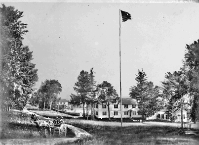
In looking for a location for his own factory, Thomas found a site on the Naugatuck River in what was then known as Plymouth Hollow, which would be renamed Thomaston.  (This is the site where the Seth Thomas Clock Factory still stands.) Plymouth Hollow was a community of only 20 houses at the time, but Thomas’s factory would soon bring excitement to the town.  Operations began early in the morning, and workers put in twelve hour days for a daily wage of between 75 cents and $1.25. Thomas ran a company store for his employees and occasionally sponsored dances. Initially his factory produced the same type of grandfather clock he made with Hoadley. However, when Thomas’s mentor Eli Terry developed a cheaper shelf clock, the market for the “tall clock” nearly dried up.  Fortunately for Seth Thomas, Terry was overwhelmed with orders and sold the rights to the patent to Thomas for $1000.  Clocks were sent by ox cart to New Haven for shipment to New York.  Business was so brisk that by 1825, both Terry and Thomas had made $100,000 in profit, and Thomas spawned cottage industries across the town in making cases and transporting supplies and products.

Seth Thomas

Seth Thomas

In later years, Thomas diversified his business holdings, opening a cotton mill in town, sponsoring railroads, and dabbling in real estate development.  In 1853, he incorporated his business as the Seth Thomas Clock Company, so that operations could continue after his death, which came in 1859, when Thomas was 74.  His clocks lived on, incorporating new brass parts, expanding into watch, alarm clock, and marine clock production, and made the famous tower clock in Grand Central Station.  The Seth Thomas Clock Factory building that stands on Main Street in Thomaston was built around 1915, and was severely damaged in the Flood of 1955. Eventually the company was bought by the General Time Corporation, which itself was bought by a series of other corporations. Operations ceased around 1980, but the name Seth Thomas lives on in the quality of his clocks, and in the name of the community, which separated from Plymouth in 1875.

Advertisement

Stone Walls

DSC_1017

With the leaves off the trees fall is a great time to explore the stone walls of White Memorial. There is, perhaps, no better-known example of man’s reshaping of the Litchfield County landscape than stone walls. Robert Thorson, author of the superb history of these creations, Stone by Stone, wrote that “abandoned stone walls are the signatures of rural New England, the “relics of a vanished agricultural civilization.”

Perhaps there is no better metaphor for the history of Litchfield County than its ubiquitous stone walls. Constructed from colonial times through the middle of the nineteenth century, they stand as testimony to the intrepid early settlers who cleared the land in the hopes of making a living from the county’s soil. In plowing their fields, they utilized these unwanted stones to dam streams, mark roadways and property boundaries and pen in livestock. Yet the explorer is struck to find these vestiges of an earlier time in the county’s deepest forests, an indication that this land was once cleared and worked but has since been reclaimed by forests as lifeways in the county changed.

DSC_1015

The stones that form these walls were deposited by the Laurentide Ice Shield 15,000 to 30,000 years ago, which scraped down to New England’s bedrock and scattered billions of stones across the region. Initially, the earliest stonewalls were built from stones obtained from quarries. The “Little Ice Age” of the 18th century, however worked stones to the surface through deep freezes and the erosion caused by spring runoffs. Thus, the clearing of stones from pastures and fields became an annual spring ritual. Farmers brought these stones to the fences that lined their properties, often by hand or by sleds pulled by oxen. Over time, these piles were reworked into more architecturally-significant structures as the supply of labor on farms grew.  Eventually the walls shaped the landscape by forcing rain to different streams or building up soils.

DSC_1033

Stone walls served several purposes for farmers. When the communal land practices of the earliest colonial days shifted to a philosophy of individually owned land, stone walls were used to define boundaries. Farmers often piled stones until they reached the lowest level of a split rail fence.  Stone pens were utilized for what Thorson has termed the “strategic dropping of manure” for use as fertilizer. Elaborate stone walls were utilized as status symbols. More than anything, however, stone walls were simply ways to dump stones that were obstacles to farmers in their fields.

New England farmers built five principal types of stone walls. These are:

DSC_1014

Dumped Wall – A simple line of piled stones.

DSC_1026

Tossed Wall – With stones stacked like firewood, this is the most common of       stone walls. It required a bit more attention that the dumped wall.

DSC_1023

 Single Wall – stones piled on top of each other. These were used to surround pastures.

DSC_1011

Double Wall – Parallel walls with smaller stones used to fill in between.

DSC_1028

Laid Wall – Featured stones in a “weave” pattern.

DSC_1019

A 1939 study estimated that there were 240,000 miles of stone walls in New England, which contained more stone than the remaining monuments of the ancient world put together. Unfortunately, Connecticut (unlike Massachusetts and New Hampshire) has no law that protects its stone walls, and they are slowly falling victim to bulldozers or being quarried for new stonework.

Hidden Nearby: Woodbury’s “Benjamin Franklin Mile Stone”

BF1

Some legends become carved in stone, or, in the case of Woodbury’s milestone, cast in iron.  The small plaque accompanying a milestone along Main Street in Woodbury states, “Benjamin Franklin Mile Stone.” The milestone itself reads “XIV M,” or fourteen miles. While there is a long-standing tradition that Franklin had these markers laid out – sometimes the legend even states that Franklin himself was involved in the placement of the stones – he was almost certainly not involved.

benjamin-franklin-520

Certain facts about the legend are true. Franklin did serve as one of two deputy postmasters general for the British colonies from 1753 to 1774. Franklin did oversee the modernization of postal roads during his tenure. And, the cost postage in that era was calculated by distance. However, there is no evidence in Franklin’s papers to corroborate the story, and while Franklin did serve as deputy postmaster general for 21 years, he was actually in the American colonies for only 6 years. The rest of the time he was in England on business representing the Pennsylvania colony.

Boston_Post_Road_map

Colonial post roads.

 A specific aspect of the legend claims that Franklin erected a series of milestones between Woodbury and Litchfield while on a trip to New England from June to November 1763. However, Franklin not only didn’t set foot in Connecticut on that trip, but neither Woodbury nor Litchfield had a post office at the time.

 BF2

Milestones had little to do with postal operations, being mostly “embellishments” set up in towns to aid passersby. Post riders were quite familiar with their routes, well aware of the mileages between different points. Still, there are mysteries surrounding the milestones. If it wasn’t Franklin, who did put them up? The series of milestones seems to be the work of different people, done at different times. And what does the distance relate to? Along modern Route 6, it is thirteen miles from Woodbury to both Thomaston and Newtown. Perhaps further study will reveal who constructed the milestone, and for what destination.

Carriage Steps

A prominent carriage step along North Street.

A prominent carriage step along North Street.

An earlier post examined the history of Litchfield’s hitching posts.   A similar reminder of Litchfield’s transportation history are the carriage steps (or mounting blocks) that dot North and South Streets.

2013-08-06 12.06.38

Mounting blocks were simple stone blocks – often granite – that allowed passengers and easier way of climbing on board a carriage or stagecoach.  Carriage steps were a fancier alternative, with two steps often carved into the stone.

2013-08-06 11.47.23

A remnant of a mounting block along South Street.

While they were often found outside the homes of the town’s wealthier residents, they speak to the importance of carriages and stages and means of transportation.  These conveyances brought students to the Tapping Reeve Law School and Sarah Pierce’s female academy.  The wealth and cultural refinement of these students helped establish the cosmopolitan atmosphere of Litchfield in the early 19th century.

A stagecoach in Farmington; it was perhaps bound for Litchfield.

A stagecoach in Farmington; it was perhaps bound for Litchfield.

Historian Lynn Brickley has written that while stagecoaches were forbidden from traveling at night, advertisements stated that the stage would leave Litchfield at 3 a.m.  A stage could travel 4-5 miles per hour, with stops every ten miles to change horses.  Still, rugged roads could slow the process, and the stage took 14 hours to travel 24 miles.

George Woodruff's centennial inscription may have served as a mounting block.

George Woodruff’s centennial inscription may have served as a mounting block.

Ultimately the arrival of the railroad would make stagecoaches no longer economically viable, and automobiles would do the same to carriages.  The implements of horse-drawn travel – hitching posts and carriage steps – remain as testimony to their importance in an earlier age.

Hidden Nearby: The Harwinton Sign Post

DSC_0298

Harwinton derives its name from the fact that it was settled in 1726 by emigrants from Hartford and Windsor, and it was originally called “Hartford and Windsdor’s Town..”  Those settlers from Hartford were given land rights in the eastern part of town, while those from Windsor were given the west side of town.  A post was put on the dividing line, and that post evolved into the Harwinton’s well-known Sign Box.

greencoverreduced

An old image of the Harwinton green, courtesy of the Harwinton Historical Society.

The sign box was designed by Lewis Smith, who served as the town’s probate judge from 1844 to 1860.  In addition to providing directions and distances to nearby towns, the sign box also provided residents a means of posting notices to their fellow townspeople in the days before other forms of communication.

DSC_0300

In 2006 a wayward motorist destroyed the sign box, which was soon replaced.  In May 2013, Larry Connors, a woodworker in town, constructed a more permanent structure and Amanda Surveski, a student at Lewis S. Mills High School, painted the letters, distances and directions.

DSC_0299

While thousands of drivers pass it every day without noticing it, the Harwinton sign box is one of those landmarks that give our New England towns their character.

Hidden Nearby: Camp Columbia State Park in Morris

DSC_0194This post is the third in a partnership with the Litchfield.bz website.  Litchfield.bz is posting video tours of some of the sites visited by this blog.  To see our video tour of Camp Columbia, click here:  http://www.youtube.com/watch?v=65RY3vqdJ4Q

Camp Columbia State Forest stands as something as a ghost town along Route 109 in Morris.  For nearly 100 years – from 1885 to 1983 – Columbia University held engineering and surveying classes on the more than 500 acre campus, which at its peak occupied nearly one square mile from the shores of Bantam Lake to the Morris/Bethlehem town line.  Here, engineering breakthroughs such as the concrete roof that would later top Madison Square Garden were pioneered.

A 1934 aerial view of Camp Columbia.  Courtesy of the State of Connecticut.

A 1934 aerial view of Camp Columbia. Courtesy of the State of Connecticut.

Land purchases began in 1903.  Prior to this the university had rented land from Mrs. Everett Waugh.  Mrs. Waugh’s farm would become the heart of the property, which soon would feature dormitories, a YMCA building with billiards and ping pong tables, a mess hall, and an astronomical observatory.   Columbia paid $10,000 for the 1903 purchases.

trench

Officer candidates participating in a World War I training program held at Camp Columbia. Photo courtesy of Columbia University.

In the years prior to World War I, a boathouse was built on Bantam Lake.  Future expansion was halted by the coming of war, and in 1917, officers’ training for the United States Army took place on the property.  Trenches were dug near Munger Lane, and mock infantry assaults swept the camp.  In 1918, the university issued an informational packet for those interested in a second round of training at the camp, which stated that the purpose was to offer “an officers’ training course for men who may be called to the National Army and desire to fit themselves for officers of noncommissioned officers in Government Service.”  The packet stated that the program was conducted by the university, not the Army, but that  it had “the approval and endorsement of the Secretary of War, and the record of the men who attended last summer shows that the course has been effective in preparing men for officers’ rank, real usefulness, and rapid advancement.”

tower

A 1940s image of the Camp Columbia tower; the tower is still standing but no longer has the hands on the clock. Photo courtesy of Columbia University.

In 1934, a fieldstone dining hall was built and eight years later the central feature of the camp, a 60 foot cylindrical water tower with an observation platform made of local stone was presented to the camp by the Class of 1906.  A 1952 Columbia University press release describes the tower as a “land-locked lighthouse, or the battlement of a feudal castle.”

columbia-university-dwight-eisenhower-1948

Dwight Eisenhower as president of Columbia University.

 Columbia engineering students blasted and leveled the hilly terrain to create a softball field and football field.  In the late 1940s, the Columbia Lions football team held their early season practices here under Coach Lou Little, who paced the sidelines at the school for 26 seasons and was inducted into the College Football Hall of Fame in 1960.  Little was supported in his efforts by the then president of Columbia, Dwight D. Eisenhower.  Ike is reported to have spent time at the camp watching practices and hunting on the grounds.

DSC_0192

The Instrument House, one of two surviving structures.

Still, the primary purpose of the camp was as a field school for engineering students, and by the early 1950s the summer program was mandatory for these students.  Courses taught at the camp included Chemical Engineering, Civil Engineering, and Technology & International Affairs.  Additionally, the Columbia University American Language Center offered classes for those international students who wished to apply to American colleges.  The presence of the 60 or so international students in 1952 – from Korea, China, Japan, Malaya, Norway, Sweden, Colombia, Greece, Canada, Brazil, Engalnd and Italy – allowed the university to declare that the camp was “a veritable United Nations in microscosm, the youngsters live together and work together with no more friction than one would find in any other college class.”

Remains of the old flag circle at Camp Columbia.

Remains of the old flag circle at Camp Columbia.

By the mid-1960s, declining student interest in the camp experience and changes to the engineering curriculum brought an end to the Engineering Department’s use of Camp Columbia.  The university maintained the grounds for special programming until 1983 when it was closed.  While the university struggled to find a buyer for the property, the buildings slowly deteriorated.  In 1989, the Town of Morris declared several buildings to be a public hazard and they were utilized in a controlled burning training exercise.

DSC_0196

Remains of an old fountain at Camp Columbia.

In 2000, the State of Connecticut agreed to purchase the grounds for $2.1 million and began to remove most of the buildings.  Today, only the boathouse, tower and instrument house still stand.  Still, for the explorer willing to walk the grounds, hints of foundations and clearings in the forest provide a glimpse into what was once a thriving intellectual community.

Hidden Nearby: Two Monuments to Sportsmen at Housatonic Meadows State Park

flyfish

This blog has typically focused on the history of Litchfield County.  While the region certainly has a rich history, it has an equally rich tradition as a place for outdoorsmen.  These characteristics intersect at Housatonic Meadows State Park.

DSC_0210

Franklin Delano Roosevelt signed the legislation establishing the Civilian Conservation Corps on March 31, 1933.  Over the next eight years , millions of men would serve in the CCC, providing income for their families ravaged by the Great Depression.

One of the first camps was Camp Cross in West Cornwall, Connecticut.  Named for Connecticut governor Wilbur Cross, it opened on June 20, 1933 and was one of the original 13 camps in the state.  Commanded by Thomas C. Hood, the camp housed the 182nd Civilian Conservation Corps, which was trained in fighting forest fires, chopping and sawing wood, and identifying trees.

DSC_0211

For their first task, the 182nd cleared 45 acres in the Housatonic Meadows State Park, which had been established in 1927.  (As the park is one the west side of the Housatonic, it is technically in the town of Sharon.) Here they also planted 45,000 red pine trees in 1933, and another 28,500 trees (red and Scotch pine, European larch, hemlock and white spruce) in 1936.  The corps also repaired and maintained roads and constructed stone walls in the park.  By 1936, the 182nd was working 6,800 acres and had mapped topographic and recreational features and catalogued trees on the property.  Their works was not without danger, however, as one corpsman was reportedly injured by a deer, two others killed a nine-foot rattlesnake, and many reported seeing “wild cats.”  The attack on Pearl Harbor eliminated the needs for the camps, but not before the CCC allowed millions of men an opportunity to help provide for their families.

DSC_0213

Housatonic Meadows State Park also contains two monuments that denote the area’s reputation as one of the finest fly fishing locales in the northeast.  In front of the campground office is a monument honoring Ranger Nate Strong that was erected by the Housatonic Fly Fisherman’s Association.

DSC_0212

Further south, near the intersection of Routes 4 and 7 is a second monument, this one honoring Francis L. Sheane, who was the chairman of the state Board of Fisheries and Game in the 1940s.

Hidden Nearby: Harwinton’s Catlin Trough

DSC_0285

The Harwinton water trough stands a memorial to the original setllers of this part of town, and to the development of the Burlington Road/Harmony Hill Road Historic District area.  Harwinton was originally Hartford and Windsor’s Town, a tribute to the original emigrants who settled it.

DSC_0284

Next to the trough is this granite marker; it was once a drinking fountain.

Among those original settlers was Major Abijah Catlin (1715-1778), who was given a land grant here in 1738.  While there is considerable debate about whether the Abijah ever moved to Harwinton, his family maintained homes and businesses in this area for five generations.  His son, Abijah Jr., operated a store and an inn at the crossroads of Route 4 and Harmony Hill Road.  Here, in 1780, Catlin served refreshments to George Washington, the Marquis de Lafayette, and General Henry Knox.  One of his descendants, George Catlin, was educated at the Litchfield Law School and served in the United States Congress.

DSC_0294

Photo courtesy of Harwinton Historical Society.

The Catlins placed a trough at this location at some point in the 18th century.  It utilized a nearby spring and gravity to provide horses and oxen passing by with a source of drinking water.  It operated until the early 20th century.

DSC_0296

Much like the Goshen animal pound, the trough reminds us of the integral role animals played in the lives of those who lived in this area two centuries ago.

The Center School Inscription

2013-08-06 12.02.13

This post is the second to be accompanied by a video hosted by litchfield.bz. You can access the video here: http://m.youtube.com/watch?v=Tql0h1SAqUE&desktop_uri=%2Fwatch%3Fv%3DTql0h1SAqUE

From the 18th through the early 20th century, public education in American towns was run through small school districts. These districts were organized around one-room schoolhouses and were situated to be within walking distance of homes. For example, when established in 1774 the school in Northfield constituted Litchfield’s 14th school district.

The school for the borough of Litchfield was located on West Street, but Arthur Bostwick who was born in Litchfield in 1860 and became a prominent librarian and author, wrote that “nobody went to it who could afford a term’s tuition at the Institute.” (This institute stood on North Street; the Wolcott Institute on South Street closed the year before Bostwick’s birth). This school was destroyed in the great fire that swept town in 1886.

Litchfield High School, on East Street.

Litchfield High School, on East Street.

Two years later a high school opened at the top of East Street. Students were required to study grammar, literature, arithmetic, United States History and geography.

2013-08-06 12.01.08

“1725 First Public School Appropriation”

2013-08-06 12.01.35

“The Center School Litchfield”

2013-08-06 12.01.42

“Bicentennial building dedicated 1925”

There was a movement In the early 20th century to combine the scattered school districts into “consolidated” or “center” schools. It was believed that this would offer students a more specialized education at enhanced economic efficiency to the town. The result for Litchfield was Center School, which opened its doors in 1925, the bicentennial of Litchfield’s first school. This anniversary was commemorated in the inscription at the top of the building. While the building has gone from housing all of Litchfield’s students to only those in grades K-3, the inscription remains as a reminder of the town’s educational history.

Hidden Nearby: The King Grist Mill Marker in Morris

IMG_3281This monument, difficult to see as cars speed along Route 109 in Morris, marks the site of the King Family Grist Mill.  The grist mill was once a vital part of New England communities.  While we usually associate grist mills with grinding wheat into flour, that was not typically the case in New England.  Here, with our rocky soil, it was far more common for farmers to raise rye, corn and buckwheat to be milled.  In fact, white bread was considered to be a luxury.

Kings_Mill_on_the_Morris_Road

An undated image of King’s Grist Mill. Courtesy of the Connecticut Historical Society.

This particular grist mill, likely built in the 1830s, was initially run by the Loveland family, who operated the mill in Morris (then called South Plains) for nearly fifty years before it was taken over by the Kings.  In addition to grinding grains, the families also utilized water power to saw timber and for the fulling (cleaning)of cloth.  The mill was described by Marilyn Nichols (who wrote its history, likely around 1905) as being “one of the old landmarks and one of the more generally known throughout Litchfield County and other sections of the state.”  Nichols described its location as being “in one of the most romantic and beautiful valleys of Connecticut.”  In fact, Nichols wrote of one local artist who gained distinction – and $400 – by selling a painting of the mill at a New York studio.

100_3892_250x397-6sec

Diagram explaining the workings of a grist mill. Courtesy of National Park Service.

The Loveland/King mill utilized two circular stones to grind.   Traditionally, both stones would have grooves cut into them to act as teeth.  The grains would be poured over the bottom stone while water power was used to turn the top stone, grinding the grain into flour.  One bushel of grain typically yielded 35 pounds of flour.   Johnnycake was the most expensive product of the mill, as it required a special bolt made from silk, and it was a particular target of hungry mice.

ct_waterbury02

The milldam for the Loveland/King grist mill was destroyed to help create the Wigwam Reservoir for the city of Waterbury.

Farmers would bring their grains to the mill, and the milling usually took place while the farmer waited.  The Lovelands were known to operate their mill until midnight to accommodate the farmers.  Millers usually received a percentage of the grain as payment, and mills often served as commodity houses where grains and flour were traded.

IMG_3282Elijah King took possession of the grist mill sometime before 1874, and while he ran it successfully for some years, changes in farming techniques and the decline of old milling practices left him bankrupt.  In fact, the prevalence of wheat flour from the Midwest and the advent of gasoline-powered engines to mill grains on the farm for animal consumption prompted Nichols to write, “obsolete is the old grist mill in Connecticut.”  Few remnants of grist mills are visible in the state, and the only trace of the Loveland/King mill, once a vital part of the local economy in Litchfield County, is the marker placed by the King family along Route 109.

Update:  Below are two maps depicting the mill.  The first is Clark’s 1859 map designating the mill as Loveland’s mill.  The second is Beers’ 1874 map, showing that King owned the mill at that point.  Note also the numerous structures in the area compared to today.

Morris Detail

Clark’s 1859 map

MorrisDetail_Beers

Beers’ 1874 map. Thanks to Linda Hocking of the Litchfield Historical Society for supplying the images of these maps!

Much of this information came from Marilyn Nichols’ lecture, available at:  “Old Grist Mills Cease” (2010-367-0) Litchfield Historical Society, Helga J. Ingraham Memorial Library, P.O. Box 385, 7 South Street, Litchfield, Connecticut, 06759